

Apps Like iAIS for iPhone and iPad
Track AIS targets and GPS data
View AIS targets plotted relative to device position. Tap targets to see speed, course, destination, type, and length. Display GPS and wind data on an instrument panel. Overlay AIS targets on Navionics charts with an in- purchase.
iAIS screenshots
Ranked alternatives
Showing 401–420 of 1,000 ranked alternatives.


AirTrack Classic
Joao Cabral
Track flight data in real time
Track flight altitude, speed, and heading in real time. Monitor waypoint progress and adjust flight path remotely. Control simulated flights via plugin integration. View navigation data wirelessly from a mobile device.

Power & Sail NZ BOI
Sail South Pacific Ltd.
Navigate anchorages and waypoints offline
Navigate safely in New Zealand's Bay of Islands waters offline. Access entry points, waypoints, and detailed anchorage information including 40+ locations with photos, videos, and activities. Find facilities, marinas, boat ramps, and dive fills.


ESA Regatta
ASTRA Yacht srl
Monitor sailing boat performance in real-time.
The app supports sailors in monitoring sailing boat performances. It provides real-time feedback on whether sailing meets selected performance levels, considering wind and boat capabilities.




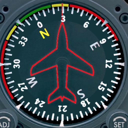
Aircraft Heading
Sean Flanagan
Track with realistic indicator
Displays a photorealistic -style indicator with both analog and digital readouts. Users can toggle rotation lock, simulate the instrument indoors, and view improved graphics. Supports latest iOS versions and includes bug fixes.


SafePilot by Trelleborg
Trelleborg Marine Systems Denmark A/S
Professional maritime piloting software from Trelleborg.
The app provides navigational data and chart display with multiple orientations. It supports S-57 and S-63 Charts and includes a vessel database for logging handled vessels.

Flytomap All in One HD Charts
Flytomap
Worldwide marine and outdoor maps.
The app provides worldwide marine and outdoor maps, including USA marine charts, lake maps, and parks. Users can download charts for offline use, overlay satellite and terrain features, and access interactive weather forecasts.


Scenic Map Western USA
Mark Granger
Explore 3D maps offline worldwide
Navigate using a 3D topographic map of the USA and Hawaii. Access offline vector maps for navigation in vehicles or outdoors. Switch to online maps for global coverage with automatic caching. Explore locations with zoom and scroll features.



How we rank alternatives
Apps are ranked by functional similarity, category fit, rating confidence, and popularity.