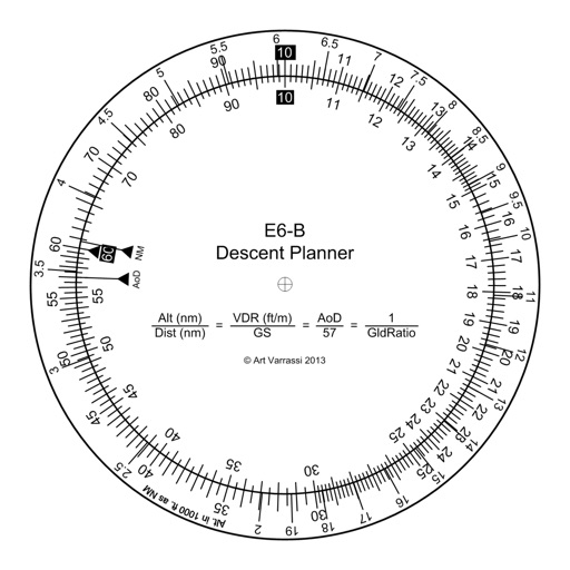
E6B Descent Planner
Arthur Varrassi
Circular slide rule for descent planning.
The app offers a functional circular slide rule for descent planning. It calculates top of descent distance, angle, rate, glide ratio, and maximum glide distance.

Altitude and context at a glance.
The app shows current altitude, latitude, longitude, and heading. It also provides weather data including temperature and atmospheric pressure.
Showing 241–260 of 1,000 ranked alternatives.
Arthur Varrassi
Circular slide rule for descent planning.
The app offers a functional circular slide rule for descent planning. It calculates top of descent distance, angle, rate, glide ratio, and maximum glide distance.

Shajir Kalady
Measure, read, track, and organize
Reader tool allows users to read and listen to books. Ruler tool measures length, breadth, and height of objects. Protractor tool measures angles of objects. Slope tool calculates the incline of structures. Activity track daily tasks and progress.

CodeBurners
Set waypoints and navigate precisely
Enter coordinates to set waypoints. Navigate to locations using latitude and longitude. View maps with metric or customary units. Track direction and distance. Save and recall multiple waypoints.

John Spinks
Map coordinates displayed worldwide clearly.
The app displays map coordinates in multiple grid formats including British Grid, Irish Grid, MGRS, and UTM. It also shows Latitude & Longitude in decimal and sexagesimal notation for global use.

Lonnie Ganz
Calculate flight paths and fuel burn
Calculate flight performance with wind and density altitude inputs. Perform fuel burn calculations and determine true airspeed. Convert units and view flight path diagrams. Save and share flight plans.

Charalampos Baltzakis
Navigate with sensor-based accuracy
Navigation provides real-time positioning using iPhone/iPad sensors. Displays maps and routes. Offers -and- interface. Uses digital filtering and stochastic models for accuracy. Only functions in airplanes.


建武 张
Record, share, and view GPS locations.
The app records GPS latitude and longitude. Users can edit location names and descriptions, view all recorded information on a list or map, and export data in multiple formats.



Craig Hunter
Navigate with 3D floating
Provides a 3D floating with realistic OpenGL graphics. Users can switch between nine modes, including direct read, traditional, and rosette styles. It displays degrees, quads, or mils.


Stephan Monette
Track and calculate density altitude
View forecasts for race tracks and custom locations. Calculate Density Altitude, Grains of Water, and HP Correction Factor. Search or add race tracks manually. Track conditions for specific locations.


BusyBytes GmbH
Navigate with compass, location, altitude, and speed
Navigation displays true and magnetic , current location, altitude, and speed. Users can track movement and view detailed compass readings. Features a clean, intuitive interface with a modern flat design.

WarthogLab
Track and route in real-time
Real-time monitoring displays current via a virtual dashboard. Set limits to receive alerts. Track driving history and statistics. Share trip data with others. Syncs with iPhone for accurate GPS readings.
Apps are ranked by functional similarity, category fit, rating confidence, and popularity.