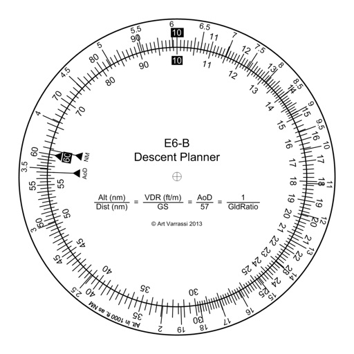
The app offers a functional circular slide rule for descent planning. It calculates top of descent distance, angle, rate, glide ratio, and maximum glide distance.
by Arthur Varrassi★ 3.514 ratingsNavigationFreeData updated 2026-10-17
Calculate -related conversions, fuel consumption, and navigation metrics. Perform arithmetic operations and unit conversions. Track time, distance, and speed. Sync with Apple Watch for real-time updates.
Navigation provides flight planning and in-flight calculations. Users can customize quick access buttons, configure units, and manage blocks and airtime.
Calculate groundspeed, true heading, compass heading, leg time, distance, fuel required, fuel flow, and endurance for flight planning. Convert airspeed, altitude, and temperature.
Navigation provides flight planning and in-flight calculations. Users can customize quick access buttons, configure units, and adjust keypads. Features include real avionics look, flight data entry, and performance calculations.
Calculate flight performance with wind and density altitude inputs. Perform fuel burn calculations and determine true airspeed. Convert units and view flight path diagrams. Save and share flight plans.
Perform calculations and unit conversions for aviation tasks. Access over 100 calculators with equations and graphics. Save and retrieve calculation results. Convert units for fuel, distance, speed, and weight.
This utility calculates average ISA temperature deviation for descent planning. It simplifies manual calculations, reduces workload, and minimizes potential errors for pilots using the FMC.
Calculate pressure and density altitudes, true airspeed, and mach number. Determine wind correction angle and true heading. Compute crosswind, headwind, and tailwind. Find ground speed and flight time. Calculate fuel burn and cloud base.
Perform aeronautical calculations including wind correction, fuel planning, and time-speed-distance. Input data to compute required values. Access multiple calculation modes and reference charts. Save and review calculation history.
Track speed using GPS with options for mph, km/h, and knots. Display city name and compass if enabled. Show traveled distance and optional average and maximum speed. Choose from multiple interface colors. Record speed during trips.
Access event schedules, speaker bios, and exhibitor details. Receive alerts and notifications. View venue maps. Customize your personal program schedule.
Monitor elevation with a large, clear display that adjusts to your device. Choose between GPS or barometric sensors. Track real-time elevation changes. View barometric pressure in multiple units. Display accuracy details visually.
Provides flight data management with downloadable weather briefings and dual data cycle support. It includes a glide ring for descent planning and a collapsible navlog for airway and procedure tracking.