Track trails with precise GPS mapping and save waypoints. Measure distances and elevation changes. Share routes and view real-time navigation updates. Sync with other devices for collaborative exploration.
Navigate waterways with detailed charts, build routes, and record tracks. View tides and currents. Set waypoints and track progress. Share maps and access free US charts for safe boating.
Monitor speed with unit switching between KM/H, MPH, and KTS. View analog or digital speedometer displays. Track journeys with detailed logging and route mapping. Integrate music playback and receive real-time weather updates.
Find lines and parcel details with accurate land data. Check boundaries, values, and owner contact information. Search for similar properties using detailed land records.
The app provides access to peak information, route descriptions, route maps, and trailhead details for Colorado's 14ers. Users can access necessary information even when off the grid and record tracks for export.
Plan routes using detailed topographic and trail data. View points of interest for rest areas, food, and accommodations. Track progress with real-time navigation and route logging. Set waypoints and save custom trails for future trips.
Track and analyze animal behavior with detailed profiles and GPS-linked stand locations. Record and store weather data including temperature, pressure, wind direction, and moon phase. View and organize deer sightings directly on the device.
Navigation allows users to view and download marine charts automatically from NOAA and US Army Corps of Engineers. Create waypoints, routes, and tracks. Use night color modes and anchor alarm. Access weather data and chart measuring tools.
The app provides access to climbing and backcountry skiing guidebooks on a mobile device. Guidebooks are available for offline use after download and offer turn-by-turn trail navigation to climbs using the device's GPS.
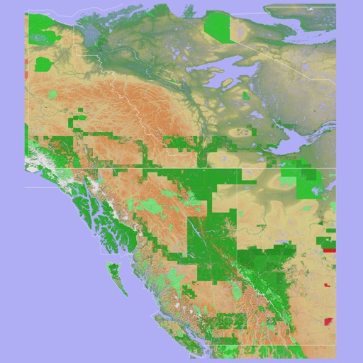
The app provides a 3D topographical map of Western Canada. Map data downloads to the device for use without an internet connection, allowing users to view terrain features as small as ten meters.
Navigate trails with detailed maps of 365+ systems and mud parks. View satellite imagery and add custom markers. Search for trails, cities, and points of interest. Record and share rides. Import trails in .kml, .kmz, and .geojson formats.
The app provides offline topographic map coverage of New Zealand's North Island. It includes satellite images, elevation data, and integrated information on land boundaries and trails.
Plan and track ski or snowboard runs with GPS navigation and 3D resort . View detailed trail information and elevation data. Record runs and analyze speed, distance, and time. Share routes and track progress over multiple sessions.