

Apps Like NavGPS for iPhone and iPad
NavGPS screenshots
Ranked alternatives
Showing 61–80 of 1,000 ranked alternatives.

Topo Maps
Mappendix Limited
View topographical maps on iPhone.
The app provides over 70,000 topographical maps from Natural Resources Canada and USGS. Users can view maps and search for over a million features without a network connection after downloading.

Mappa - Watch Maps
Nick Romano
Track workouts, view metrics, export routes
Record workouts with heart rate, speed, elevation gain, and other metrics. Import and export GPX and FIT files. View offline with custom tiles. Overlay routes from GPX, FIT, KML, or GeoJSON files. Generate walking and cycling directions.
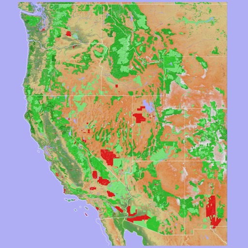
Scenic Map Western USA
Mark Granger
Explore 3D maps offline worldwide
Navigate using a 3D topographic map of the USA and Hawaii. Access offline vector maps for navigation in vehicles or outdoors. Switch to online maps for global coverage with automatic caching. Explore locations with zoom and scroll features.

Maine Lakes - GPS fishing maps
Flytomap
Navigate with marine and outdoor
Navigate with marine and outdoor offline. Overlay satellite and terrain data on charts. Access local weather forecasts. View worldwide and satellite imagery when connected. Use NOAA raster data for detailed navigation.

WeTrek – Trail, Hike & Cycling
Ubicarta
Explore routes and POIs outdoors
Explore outdoor routes and points of interest with layered maps. View IGN maps, aerial photos, and OpenStreetMap for hiking and . Access Spain and Swiss maps, emergency call coverage in France, and winter trail information.

ForeFlight Mobile EFB
ForeFlight, LLC
Plan flights, check weather, track position
Weather "View current conditions, forecasts, and radar maps. Set location-based alerts. Customize notifications for severe weather. Share forecasts with others."

TZ iBoat – Marine Navigation
Nobeltec, Inc.
Navigate with real-time GPS and tidal data
Navigate using GPS, AIS Online, and radar. View charts for coastal boating, sailing, and fishing. Track tides and currents. Set anchoring points. Sync with Apple Health. Share routes and waypoints.

Track N Trail - Hunting & Maps
Track N Trail LLC
Blood trails and view land
’n detects blood trails using machine vision and color-isolation technology. Users receive alerts and can map blood trails. The includes land ownership for tracking game. Features include blood detection, mapping, and land ownership information.


RidePal - Find Trails, Compete
TalkUp LLC
Track rides with GPS and analytics
Track mountain bike rides with GPS to record speed, distance, elevation, and analytics. View trail details, difficulty ratings, and save routes. Share rides, on segments, and earn achievement badges.

Mgrs & Utm Map
Vahid Cataltas
Navigate with GPS and coordinates
Display current location using GPS, GALILEO, and GLONASS. View position on various map layers. Import and export KML files. Navigate with coordinate systems. Track movement during outdoor activities.

Scenic Map Eastern USA
Mark Granger
Explore 3D maps offline worldwide
Navigate using a 3D topographic map of the USA with offline access. View vector map data without internet. Use in vehicles or during hikes. Switch to global online maps with automatic caching for areas without coverage.

Mapy.com: Walking & Cycling
Seznam.cz a.s.
Plan routes with elevation profiles
Plan routes for hiking, cycling, cross-country skiing, and ski-alpine trails. View elevation profiles and 5-day weather forecasts for any location. Explore global tourist maps with trails, paths, and hillshade terrain.

Lowrance: app for anglers
Navico Norway AS
Navigate, track, and plan fishing trips
Manage waypoints by creating, storing, editing, and organizing them. View detailed fishing maps for accurate charting. Sync data with devices. Log favorite fishing spots and plan trips. Share waypoints across devices.

iHikeGPS : Classic Topo Maps
James Associates Inc.
Navigate with topographic and GPS
Track location and movement with GPS. View USGS, US Forest Service, and Canadian . Log trails and waypoints. Navigate offline in areas without cell signal. Display elevation and terrain details. Share route data and historical tracks.


USFS & BLM Campgrounds
Kyle Modesitt
Find and check weather
Find managed by the United States Forest Service or Bureau of Land Management. View campground details including name, agency, weather, elevation, and images. Search and locate nearby sites. Share location data with a Road Trip Planner .
How we rank alternatives
Apps are ranked by functional similarity, category fit, rating confidence, and popularity.