

Apps Like onX Hunt: GPS Hunting Maps for iPhone and iPad
Plan hunts, view , track land boundaries
Plan hunts by viewing species distribution and 3D . Access units and land boundaries. Save offline and mark waypoints. Track weather conditions and property lines. Use satellite, lidar, and hybrid basemaps for terrain analysis.
onX Hunt: GPS Hunting Maps screenshots
Ranked alternatives
Showing 401–420 of 1,000 ranked alternatives.

GBTopoMap
Right Place Resources Limited
Pan and zoom maps offline
Provide offline topographic maps of Great Britain with pan and zoom capabilities. View detailed terrain features and scale at 1:25k. Use for outdoor activities like hiking, cycling, and hunting in areas without cellular coverage.

MetroMap NYC - MTA Network
DXB Technologies
Browse subway maps and stations
View subway and local train maps for New York City. Search stations by name. Zoom with pinch-to-zoom. Close and reopen without reloading. Load maps instantly with high-quality images. Navigate offline without internet connection.

RealityMaps 3D tour planner
3D RealityMaps GmbH
Track routes and explore 3D maps
Plan and track outdoor routes with 3D terrain views. Measure elevation changes and distance. Save and share custom trails. Access real-time GPS navigation and offline maps. Adjust routes based on elevation and difficulty.

Pennsylvania Pocket Maps
Alex Gugel
Download and guides for parks
Plan trips to parks with downloadable , guides, and park brochures. Access 75+ national and state parks, 150+ from various agencies, 100+ campgrounds, 1,600+ trails, and 72,000+ points of interest.


Oregon Pocket Maps
Alex Gugel
Plan trips and download offline
Plan trips to parks with downloadable and guides. Access 125+ parks, 400+ from various agencies, and 1.700+ campgrounds. View Motor Vehicle Use and visitor for national forests.

Peakbagger
Andrew Kirmse
Track climbs, measure progress, and explore mountains
Track climbs and manage offline data for mountains. Search a large database of peaks and trip reports. Measure progress against peak lists. Get route details and directions. Find nearby peaks or filter by prominence and climb status.


Cityscribe: Save Your Places
Nolan Fuchs
Discover , favorites, share locations
And customize lists by adding favorites to existing or new lists. Set names, cover images, and organize items. Share saved locations with others via links or social media.

No Roads
i3 Product Development, Inc.
Map trails, record tracks, explore offline
Navigate off-road trails by dropping waypoints and recording tracks. Explore curated trails and points of interest. Receive real-time hazard alerts and trail conditions. Download maps for offline use. Access detailed weather and elevation data.


NDRoads
North Dakota Dept. of Transportation
NDDOT mobile travel information app
The app displays travel information for the public. Users can interact with maps, view travel messages, and access weather cameras.
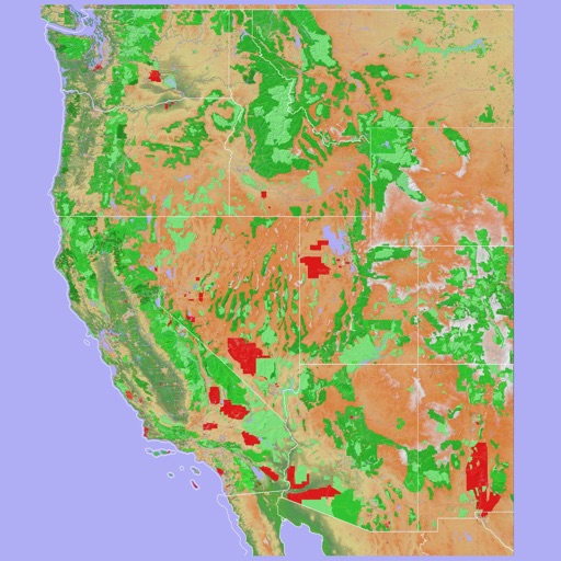
Scenic Map Western USA
Mark Granger
Explore 3D maps offline worldwide
Navigate using a 3D topographic map of the USA and Hawaii. Access offline vector maps for navigation in vehicles or outdoors. Switch to online maps for global coverage with automatic caching. Explore locations with zoom and scroll features.

Compass 54 Pro
Elen Bekzadyan
Real compass with location and weather.
The app displays device orientation to magnetic fields. It provides location coordinates, course, speed, altitude, weather information, date, time, and map views.




How we rank alternatives
Apps are ranked by functional similarity, category fit, rating confidence, and popularity.