
Pennsylvania Pocket Maps
Download and guides for parks
Alex Gugel
iPhone Screenshots

iPad Screenshots


Description
Plan trips to parks with downloadable , guides, and park brochures. Access 75+ national and state parks, 150+ from various agencies, 100+ campgrounds, 1,600+ trails, and 72,000+ points of interest.
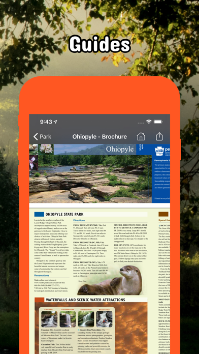
Be prepared! Plan your next trip to one of the great Pennsylvania parks. Download maps and guides before you venture into the Wi-Fi free wilderness.
Discover
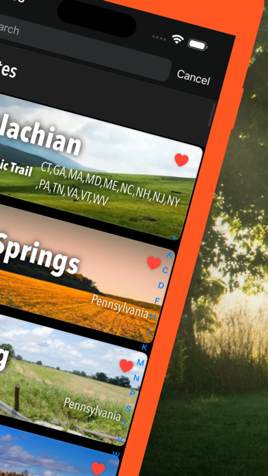
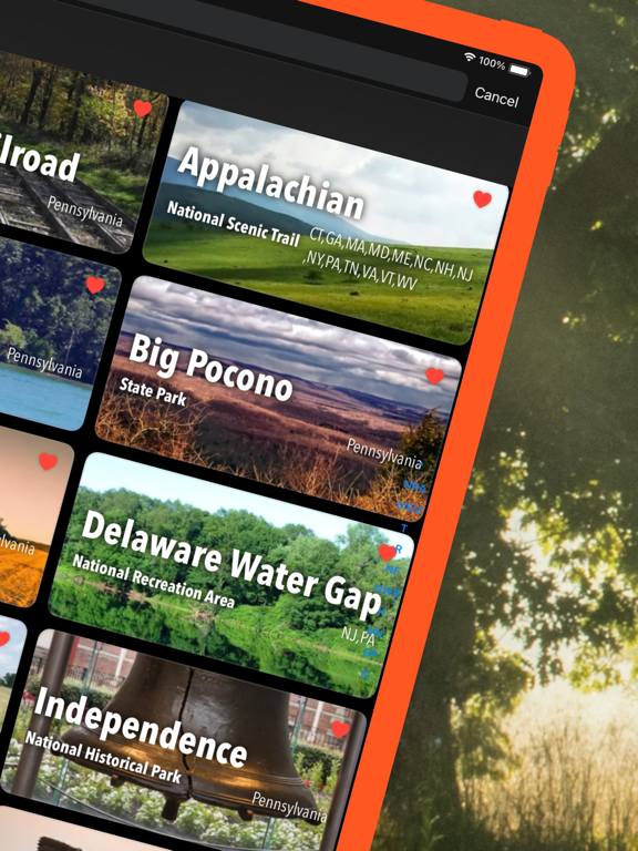
- 75+ national parks, state parks, monuments, forests
- 150+ neatly folded maps by the National Park Service, Bureau of Land Management, United States Forest Services, and other agencies.
- 100+ campgrounds and campsites
- 1,600+ trails and trailheads
- 72,000+ points of interests
Plan
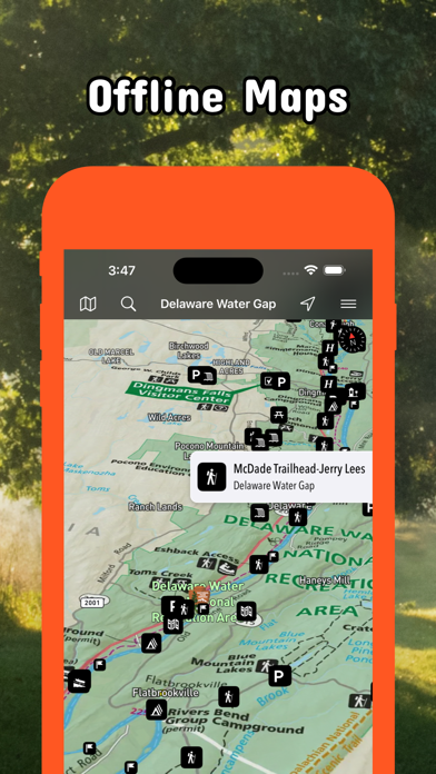
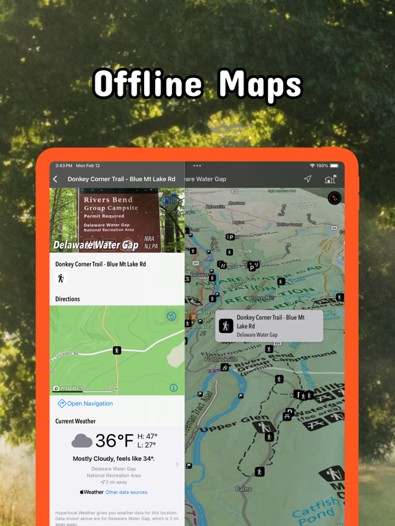
- Download maps, park brochures, and newspapers. These downloads are ready when you are offline and off the grid in the great outdoors.
- Download arbitrary map sections as offline packs.
- Photo galleries, panorama views.
- Share links to parks and maps with friends
Have fun
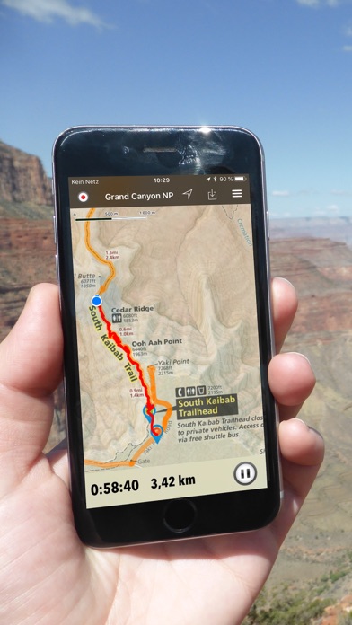
- GPS and GPX support: record your hikes, import GPX routes, tracks and waypoints for your hiking trails.
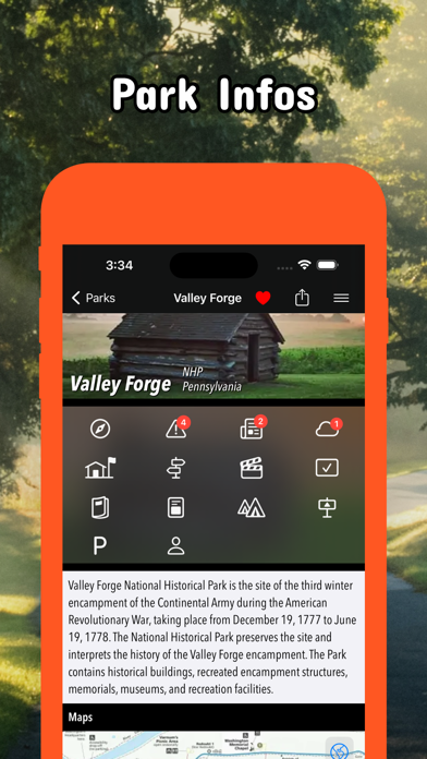
- Detailed national park information: alerts, news, visitor centers, campgrounds, driving directions, weather.
- Open your favorite maps app to get a route to the selected park.
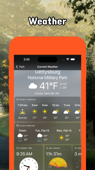
- Current weather conditions, easy access to multi-day forecasts, sunrise and sunset times.
- Push notifications for park alerts, park news, weather warnings
So download maps and guides for:
* Allegheny, Allegheny Islands, Allegheny Portage Railroad, Appalachian, Archbald Pothole
* Bald Eagle, Beltzville, Bendigo, Benjamin Rush, Big Pocono, Big Spring, Black Moshannon, Blue Knob, Boyd Big Tree, Buchanan's Birthplace, Bucktail
* Caledonia, Canoe Creek, Captain John Smith Chesapeake, Champman, Cherry Springs, Cherry Valley, Chesapeake Bay, Chesapeake Bay Gateways and Watertrails Network, Codorus, Colonel Denning, Colton Point, Cook Forest, Cowans Gap
* Delaware & Lehigh, Delaware Canal, Delaware Water Gap, Denton Hill
* Edgar Allen Poe, Eisenhower, Elk, Erie, Erie Bluffs, Evansburg
* First State, Flight 93, Fort Necessity, Fort Washington, Fowlers Hollow, Frances Slocum, French Creek, Friendship Hill
* Gettysburg, Gifford Pinchot, Gloria Dei Church, Gouldsboro, Greenwood Furnace
* Hickory Run, Hopewell Furnace
* Independence
* John Heinz at Tinicum, Johnstown Flood, Journey Through Hallowed Ground
* Kinzua Bridge
* Laurel Hill, Laurel Ridge, Lehigh Gorge, Lower Delaware
* Moraine
* Nockamixon, North Country,
* Ohiopyle, Oil Creek, Oil Region
* Potomac Heritage, Presque Isle, Prince Gallitzin, Pymatuning
* Raccoon Creek, Ricketts Glen, Rivers of Steel
* Shawnee, Steamtown,
* Thaddeus Kosciuszko, Tobyhanna
* Upper Delaware
* Valley Forge
* Washington-Rochambeau Revolutionary Route
App information from Apple App Store. Pennsylvania Pocket Maps and related trademarks belong to Alex Gugel.