
MyMeasure
Pendlebury Software LLC
Measure map features quickly and easily.
The app measures length, perimeter, and area on a map using an interactive crosshair. Users can trace map features, and dimensions update continuously.
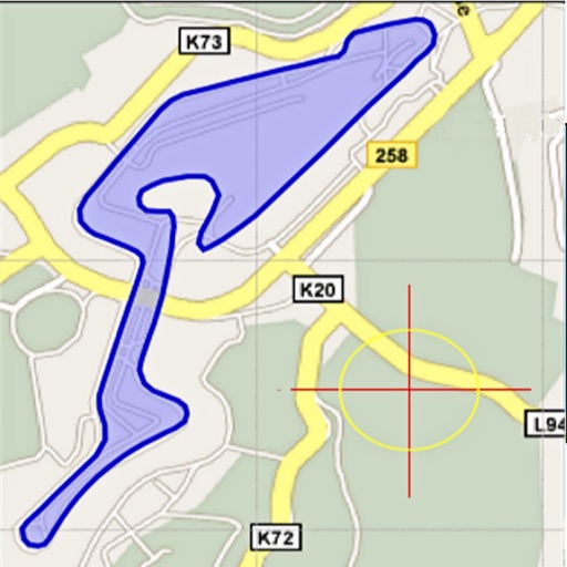
Area, length, and angles on maps
Area, lengths, and angles on maps using an interactive crosshair. Trace outlines to create connected points, updating area and perimeter in real time. Adjust radius for scaling features. View dynamic length and angle as you move the crosshair.
Showing 1–20 of 1,000 ranked alternatives.
Pendlebury Software LLC
Measure map features quickly and easily.
The app measures length, perimeter, and area on a map using an interactive crosshair. Users can trace map features, and dimensions update continuously.

Level Labs, LLC
Measure, level, and plan with AR tools
Measure distances, heights, and angles using AR measure, ruler, and level tools. Create floor plans and calculate areas. Take screenshots, use flashlight, and chain measurements. Switch between imperial and metric units.

Pravin Gondaliya
Land and calculate distances with GPS
Land and distances using GPS by marking points on a map. Calculate field size, plot dimensions, and property boundaries. Save and share measurement data. Sync with other devices for accurate field surveys.
AI Photo Editor Lab SRL
Measure objects with AR precision
Measure distances using augmented reality or direct phone contact. Calculate surface areas and angles. Create floor plans and save measurements. Share results via email or messaging.

LOGISIAN TECHNOLOGY SOLUTIONS PRIVATE LIMITED
Measure areas and distances
Measure areas and calculate distances using GPS. Draw polygons on maps to calculate field areas. Save and share data. Access detailed maps and satellite imagery for accurate surveying.

Rento UAB
, track distance, share results
Distances, perimeters, and areas using GPS. Place markers on or objects. Share results with colleagues. Calculate quantities like spray or fertilizer needed. Export measurements for record-keeping.

Applorium Ltd
Calculate from coordinates
Calculate using coordinates with options for square meters, feet, acres, hectares, kilometers, and miles. Measure distance between points. Premium users can save areas, add notes, attach images, and calculate prices based on values.

Calculated Industries, Inc.
Solve U.S. and metric unit conversions.
The app converts U.S. and metric units for measurements, including linear, area, and volume dimensions.

忠 张
Distance and area on maps
Distances and areas on satellite maps. Select points to calculate length or size. Save measurements and share results. Compatible with various map views and zoom levels.

RIEU Limited
Distances and save areas with your device
Lengths and areas using your mobile device. Select from multiple measurement modes including point-to-point and area. Save screenshots or measurements for later. Change units of measurement as needed.

Chengdu qianduolai Technology Co., Ltd
Set - actions and adjust settings
Allows users to create and customize automated sequences within a built-in web interface. Magnifier provides zoom functionality for detailed viewing. Users can adjust intervals and repeat actions.

Core Signals LLC
Measures distances and land areas.
The app measures distances and land areas on maps. Users can measure outdoor projects like lawns, fences, and paving visible on the satellite map.

Xuan Luong Do
Distance between two points
Distances between two or more points on a map. Place markers to calculate straight-line distance. Sum total distance for multiple locations. View distance in kilometers or miles.

AppFusion OU
Objects with AR precision
Objects using augmented reality to determine length, height, and area. Align the phone's camera with the object and tap to get precise measurements. Share results via email or messaging apps.

忠 张
Distance and area on maps
Distances and areas on satellite maps. Select objects like lawns, roads, and buildings. Save and share measurements. Export data in various formats. Sync with other apps for project planning.

Tue Nguyen Minh
Measure angles in degrees and radians
Measure angles using your iPhone as a protractor. Select degrees or radians. Adjust the angle visually with intuitive controls.

Infatics, Inc.
Plan and share drone missions
Plan and execute drone flights with pre-programmed missions. Capture and view high-resolution aerial images and videos. nd share interactive maps, orthomosaics, and 3D models. Manage data and settings directly from the mobile device.

Wondershare Technology Group Co.,LTD
Edit, scan, convert, and chat with PDFs
Edit and convert PDFs with AI-powered tools. Chat with PDFs, translate documents, and detect grammar or AI-generated content. Summarize text, scan pages, and annotate files. Share and export in various formats.

MapRight, LLC
Explore properties in 3D with one tap
Explore properties using 3D visualization and detailed data cards. View terrain topography with contour lines. Identify and map properties with ease. Check fiber optic availability and groundwater details. Access property data with one tap.

Apps are ranked by functional similarity, category fit, rating confidence, and popularity.