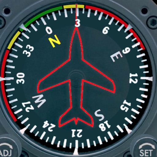
Displays a photorealistic -style indicator with both analog and digital readouts. Users can toggle rotation lock, simulate the instrument indoors, and view improved graphics. Supports latest iOS versions and includes bug fixes.
by Sean Flanagan★ 2.212 ratingsNavigation$0.99Data updated 2026-11-09
Monitor and filter radar alerts using real-time data and historical analysis. View detected signals, customize filtering settings, and receive updates on false alerts. Sync with compatible radar detectors for live monitoring and threat detection.
Track position, height, and acceleration with accuracy in feet, meters, miles, or kilometers. Log maximum altitude and speed. Display and save current or waypoints on a map. Choose coordinate formats for viewing.
Measure acceleration, orientation, and motion with built-in sensors. Record and analyze real-time data for experiments. Detect and generate sound tones. Visualize audio waveforms. Export measurements and graphs for scientific use.
Navigation allows users to view and share GPS coordinates in six formats. It includes a , altitude, distance, and sunset/sunrise tracking. Users can set and edit waypoints with photo or audio notes.
Customize buttons and analog thumbstick settings. Create and manage on-board profiles. Adjust advanced features like d-pad SOCD cleaning. Remap controls for different games or tasks.
The app displays current speed in real-time using the iPhone's GPS receiver. It features analog or radioclock style displays and an optional HUD mode for projection onto a windshield.
Navigate using a or true . Set direction references and adjust settings. Track altitude and barometric pressure changes. Measure electrical fields with the teslameter. Use the flashlight and Morse code transmitter for signaling.
Track in meters or feet with real-time updates. Display GPS accuracy and battery usage. Works offline with a clean interface. Ideal for hiking, flight tracking, and outdoor activities.
The app measures the elevation of locations within a 500-meter radius using device sensors and internet-based geo information. It calculates altitudes in real time and displays them in meter or feet.
Locate lost Bluetooth devices by scanning for signals. View device list and select a target. Receive distance feedback as you move closer. Indicator changes from cold to warmer and hot when near the device.
Predict satellite and ISS sightings with second-level accuracy. Track Starlink satellite trains. Set reminders for upcoming events. Show compass direction and elevation for precise viewing. Countdown to sightings second by second.
The app offers a minimalistic interface for tuning string instruments using the device's microphone. It includes numerous guitar tunings and options for various other instruments, with custom note tuning capabilities.
Monitor network status and device information. Clean storage with phone and tablet . Block Safari ads. View battery and charging animations. Access photo editing tools. Securely store sensitive data in a vault.
Locate lost Bluetooth and using real-time tracking. Play a game to with Cold, Warmer, Hot feedback. Save for faster searches. Track multiple simultaneously.