Track , paragliders, planes, and helicopters in real time with live position and flight path data. View airfield details including frequencies, runways, and METAR reports. Access rain radar, cloud layers, and flight time calculations.
The app provides pilot weather and notam information from Airservices Australia. Users can submit flight notifications, amend flight plans, and access location briefings and charts.
Control drones via a remote connection. View live video streams and share them with incident commanders. Log flight data automatically. Adjust drone settings and monitor battery life in real time.
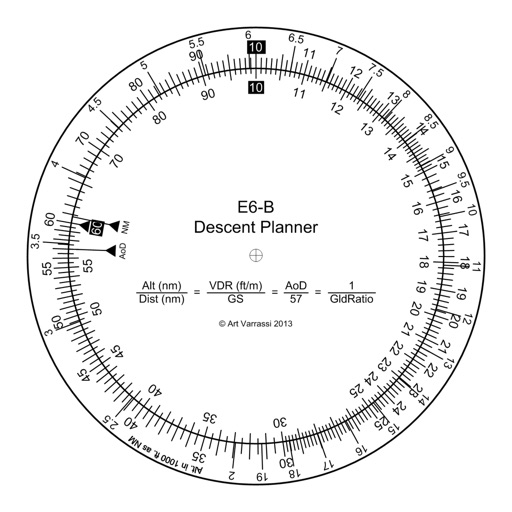
The app offers a functional circular slide rule for descent planning. It calculates top of descent distance, angle, rate, glide ratio, and maximum glide distance.
The app displays Canadian weather radar, satellite imagery, and various charts. Users can view radar animations, select from 31 stations, and animate up to 100 images.
Book shared rides by selecting pickup and drop-off points or tapping on a map. Choose departure time and view available options. Receive in- notifications before your ride starts. Track real-time ride progress and estimated arrival time.
Access aeronautical charts, aerodromes, and waypoints for navigation. Visualize flight paths and chart details. Search for airports and waypoints. Save and organize charts for easy reference during flights.
The app presents current weather conditions, 3-hourly, and daily forecasts for any town. It also offers near real-time local and animated wide-area satellite views.
The app provides expert advice for planning trips to Alaska, including information on accommodations, tours, and attractions. It also highlights local knowledge, outdoor recreation, dining, and videos showcasing destinations.
Measures altitude using barometric pressure. Adjust Kollsman setting for current barometer or set to 29.92 inches of mercury. Syncs with iPhone 6 and later models using Apple and Bosch sensors. Does not support older iPhone or iPad models.
Book rides for passengers with disabilities within three-quarters of a mile of a fixed-route bus stop. Request wheelchair-accessible vans. Schedule pickups and drop-offs. Receive assistance from operators during trips.
Check air quality for your current location and up to 10 custom locations. Receive notifications when air quality changes. View hourly data from the Real-Time Air Advisory Network. Add or remove locations and personalize settings.
Navigation provides real-time positioning using iPhone/iPad sensors. Displays maps and routes. Offers -and- interface. Uses digital filtering and stochastic models for accuracy. Only functions in airplanes.