Allows users to activate a panic button to call 911. It sends immediate alerts to nearby law enforcement officers in the Hero911 Network. It also sends intra-campus alerts to designated personnel.
View PDF, TIFF, KAP, and KML files. Sync with iCloud, Google Drive, OneDrive, and Dropbox. Add placemarks, record tracks, and draw shapes. Share annotations in real time. Use tools like theodolite and georeferencer for map editing.
Securely connect to the internet with end-to-end encryption to protect data on public and private networks. Toggle encryption on or off. Access a global network of servers. Stream media without buffering.
Turn your iPhone into a wireless external . , copy, and backup files between devices over . Access files via any browser using a designated IP address. No additional software required. Sync files between iPhone and PC/Mac/Linux devices.
Receive location data via email and map it automatically. Visualize GPS coordinates with a radius overlay. Get notifications for location updates. Share mapped locations with others. Set custom radius sizes and track movement patterns.
Access real-time location data and digital maps of tourist sites. View official paper maps alongside digital navigation. Search for points of interest and get directions. Bookmark locations and share maps with others.
Displays altitude using a digital readout and an analog gauge. Tracks maximum height reached during use. Shows altitude accuracy and sensor quality. Utilizes GPS and barometric sensor for precise measurements.
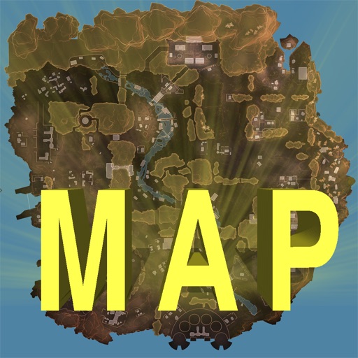
Track locations, respawn beacons, survey beacons, crates, and jump towers. Toggle points of interest on and off. Share markers with friends to coordinate strategies. View interactive map with detailed location data.
Monitor and altitude using the device's internal sensor. Track changes to predict weather patterns. Provides altimeter readings for elevation awareness.
Record routes for walking, running, or traveling. Manually adjust positions along the . Add GPS coordinates to photos without using photo editors. Track movement and save location data for later reference.
View topographic of for hiking, camping, and outdoor activities. Choose between Base Map and Toporama sources. Download for offline use. Track location, elevation, and movement on the map.
Create detailed property maps with irrigation, tree, and electrical system placements. Assign tasks to team members for project management. Collaborate on shared project plans and track progress in real time.
Create and edit spatial data files using text or dBASE formats. Generate KML/KMZ files for map locations. Display icons, circles, cylinders, lines, and polygons. Add images with midpoint or corner points.