Access aviation and navigation data for flight simulation. View Jeppesen and IFR coverage at airports worldwide. Download and manage for use in simulated flights. Sync with flight simulation software for real-time data.
by Navigraph KB★ 4.92,741 ratingsNavigationFreeData updated 2026-09-10
Track ship positions using AIS data with over 1 million targets and 300K updated ships daily. Access weekly updated nautical charts and replay ship trajectories for 3 months.
Fly aircraft in a detailed 3D environment covering and Abu Dhabi. Choose from 13 planes, customize weather conditions, and adjust turbulence and wind settings. Simulate day and night flights with realistic atmospheric parameters.
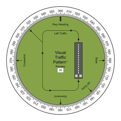
Allows pilots to view runway patterns with finger rotation. Display includes left and right patterns, crosswind, downwind, base, and 45-degree entry headings. Magnetic runway orientation matches aircraft heading for approach visualization.
Control a skateboard with one finger to navigate levels. Avoid obstacles, collect coins, and unlock skins. Compete on Game Center leaderboards and track progress through multiple stages.
The app provides flight planning for New Zealand with a waypoint database and VFR/IFR planning. It includes graphical weight and balance, and displays routes on a Google Earth map.
Determine flight path relative to objects by positioning the sight target on cloud tops, mountain passes, or other aircraft. Receive visual indication of whether the object is higher or lower and the degree difference.
The app allows users to view upcoming event details for live music, comedy, and theatre. Users can buy tickets, add events to their calendar, set reminders, view FAQs, get directions, and view seating charts.
Plan flights, track performance, access real-time data
Plan flights with real-time performance data and predictive analytics. Input aircraft details to calculate fuel consumption and optimal routes. Access weather information and regulatory data.