
DWD FlugWetter
Deutscher Wetterdienst
Aviation weather for Germany and Europe.
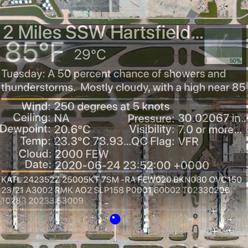
The app provides aviation weather information for Germany and Europe. It includes METAR, TAF, meteograms, cross sections, weather warnings, and forecasts up to 78 hours.

Plan flights, track weather, view maps
Plan flights with detailed weather data, airport information, and NOTAMs. Overlay georeferenced charts on aviation maps. Access IFR and VFR plates for over 200 countries. Manage and download airport plates in advance.
Showing 321–340 of 1,000 ranked alternatives.
Deutscher Wetterdienst
Aviation weather for Germany and Europe.
The app provides aviation weather information for Germany and Europe. It includes METAR, TAF, meteograms, cross sections, weather warnings, and forecasts up to 78 hours.


Daniel Fernandez Garcia
View cameras and track incidents in real
View cameras and incidents on a map. Add cameras to favorites for easy access. Check road closures and MDOT mobility notices. Get real-time updates on highways.




Uffizio India Software Consultants Private Limited
Track vehicles and monitor routes
Track vehicle movement with real-time GPS updates. Monitor routes and locations globally. Set up alerts for unauthorized movement. Share location with contacts. View maps and navigation directions. Receive trip history and fuel efficiency reports.


Flytomap
View maps, navigate routes, track location
View detailed and with vector-based maps that remain clear at any zoom level. Pan, tilt, and rotate for an immersive experience. Purchase additional features within the for expanded functionality.

Garzotto GmbH
Digital maps of Austria with features.
The app provides digital maps of Austria with hill shading and object names. It includes topographic maps and offers functions like searching by name or coordinates, GPS features, and measuring distances.



Apps are ranked by functional similarity, category fit, rating confidence, and popularity.