iPad Screenshots

Description
The most comprehensive coordinate and mapping tool.
LUC is a powerful coordinate converter and mapping application developed for field professionals, outdoor users, and map enthusiasts.
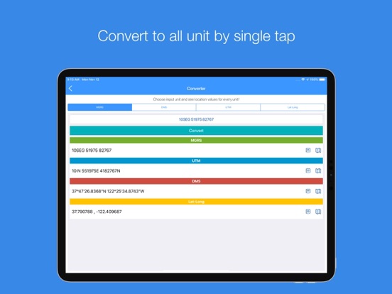
Advanced Coordinate Conversion
Supports MGRS, UTM, ED50, Swiss Grid, British National Grid, Lat/Long, Geohash, GeoRef, Maidenhead, and many more formats.
Powerful Map Experience
Work with satellite, topographic, terrain, and night map styles. Use maps offline, add layers, and customize your experience.
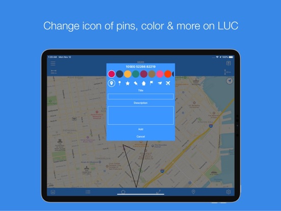
Professional Measurement & Drawing Tools
Draw polygons, polylines, and circles. Calculate distance, area, and elevation. Add dozens of markers directly onto the map.
Activity & Live Tracking
Record your route in real time during walking, running, or fieldwork. Export all activities in GPX format.
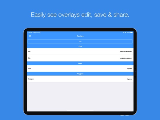
Sharing & Export
Export your drawings and layers in GeoJSON or KML format and share them easily via a link.
Live Layers
Share a layer without exporting it again after every update. Send invitations, manage access, and instantly share up-to-date data with others.
With LUC, coordinates and maps are always at your fingertips.
App information from Apple App Store. MGRS, UTM, DMS & ED50 - LUC and related trademarks belong to Mustafa Ismail ALKAN.