

Apps Like Hiking Project for iPhone and iPad
Explore hikes with GPS and maps
Find trails with detailed GPS routes, elevation profiles, and interactive maps. View photos and expert insights for each trail. Search for hikes by location or area. Plan routes with suggested highlights and difficulty levels.
Hiking Project screenshots
Ranked alternatives
Showing 321–340 of 1,000 ranked alternatives.




Ride PA
Mapgears Inc.
Track trips and list equipment
Track trips with breadcrumb navigation, speed, and distance statistics. Log equipment details and note vehicle-specific distances. Access satellite view for enhanced map navigation.


NZ Topo50 South Island
Right Place Resources Limited
Offline maps for South Island exploration.
The app provides offline topographic map coverage of New Zealand's South Island. It includes satellite images, elevation data, and integrated data for various outdoor activities.

BoRa Rio
FUBA EDUCACAO AMBIENTAL E CRIATIVIDADE LTDA
Explore landmarks with interactive maps
Navigate the park using detailed geolocated maps. Access educational content about biodiversity, history, and architecture. Explore curated routes and trails for an interactive visit.



Le Dévoluy.ski
DEVOLUY SKI DEVELOPPEMENT
Discover the Dévoluy mountain range now.
The app provides information about the Dévoluy mountain range and its resorts. Users can find piste maps, trail maps, real-time ski run openings, snow conditions, weather forecasts, webcams, event listings, and local services.

GreenVelo Trail
Amistad Spolka Z Ograniczonia Odpowiedzialnoscia
Find attractions and cycling routes
Find nearby attractions, cycling routes, and points of interest. Search for accommodations, restaurants, and Biker Service Areas. Create a shortlist of favorites. View event calendars and latest news updates.

Explore Asheville
Buncombe County Tourism Development Authority
Plan trips, book tours, and
Plan trips with detailed itineraries for attractions like Biltmore Estate and Blue Ridge Parkway. Find hiking trails, arts events, and craft breweries. Get maps, opening hours, and local recommendations. Book tickets and accommodations directly.

Mt. Ashland Ski Area
Mt. Ashland Association
Track snow conditions and lift status
Access real-time mountain operations, weather updates, and personalized alerts for fresh powder, lift closures, and parking status. Buy and manage lift tickets, lessons, rentals, and passes. Order lunch remotely and locate friends on the slopes.

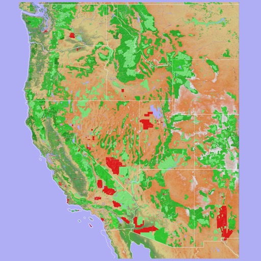
Scenic Map Western USA
Mark Granger
Explore 3D maps offline worldwide
Navigate using a 3D topographic map of the USA and Hawaii. Access offline vector maps for navigation in vehicles or outdoors. Switch to online maps for global coverage with automatic caching. Explore locations with zoom and scroll features.

HexaTrek : Thru Hike France
Kevin Ginisty
Navigate the trail and parks
Navigate a 3034 km trail through French mountain scenery, linking 14 natural parks from the Vosges to the Pyrenees. Track progress, view maps, and access trail markers. Find bivouac sites, plan stops, and explore villages along the route.


How we rank alternatives
Apps are ranked by functional similarity, category fit, rating confidence, and popularity.