

Apps Like Vogtland for iPhone and iPad
Discover Vogtland's attractions and routes.
The app provides information for stays in the Vogtland, featuring hiking and cycling routes, accommodations, and excursion tips. It includes a tour planner, POI display, event information, and location tracking with offline storage.
Vogtland screenshots
Ranked alternatives
Showing 261–280 of 1,000 ranked alternatives.

SkiStar
Skistar AB
Get weather, tips, and SkiPasses
Receive real-time weather updates and activity suggestions for ski and summer destinations. View maps with facility locations. Purchase and refill lift passes with Swish payments. Access restaurant and shop recommendations.



Orientation: Compass & Map
chaviro software
See places relative to current position.
The app displays up to six chosen locations simultaneously. Users can view the direction and distance to each selected place on a compass and check their coordinates.




Compass Ω
Generative Pictures LTD
Navigate with accurate GPS and coordinates
Display GPS coordinates in DMS, DDM, or DD formats. Show altitude in feet or meters. Track speed with a speedometer. Share coordinates. Switch between magnetic and geodetic north. Use flashlight for nighttime. Provide location data.

Great Places 2 See
Great Places 2 See with Audio Tours, LLC
Navigate with audio guides and maps
Travel "Receive audio commentary as you drive. View maps and points of interest. Access event listings and festival information. Get turn-by-turn navigation with location-based highlights."


TOTAGO: Maps, Parks & Trails
OPENPLANIT LLC
Explore , bike routes, and hiking paths
Find hiking , bike routes, and nature spots in major cities. Get turn-by-turn directions by foot, bike, car, or public transit. Download maps and guide content for offline use.



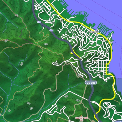
Mapster
Syzygy Research & Technology Ltd.
View maps, download trails, store routes
View and download detailed maps with topographical hillshading and contour lines. Store maps for offline use. Navigate using detailed terrain features. Find hiking trails, ski runs, and back streets.


Geographica | offline map
keiji matsumoto
Offline GPS navigation for outdoor adventures.
The app provides offline GPS navigation for hiking and mountaineering, displaying the user's location on topographic maps. It allows users to record their routes and works without cell service.

Where2Go: GPS Photo Compass
Pavel Vorontsov
Navigate with GPS and saved points
Navigate using a GPS to any saved location. Save current position, input coordinates manually, or extract GPS from photos. View saved points history and export coordinates to Google or Apple Maps.
How we rank alternatives
Apps are ranked by functional similarity, category fit, rating confidence, and popularity.