
SkyPilot GPS Dashboard
Christoph Schulz
Track location, speed, and heading
Track location, speed, altitude, and heading using built-in GPS. Customize with widgets for quick access. View real-time movement data and adjust settings for navigation.

Barometric pressure to altitude conversion.
The app converts barometric pressure to altitude above sea level. It displays current elevation, cabin altitude, and vertical speed, and saves maximum and minimum altitudes.
Showing 161–180 of 1,000 ranked alternatives.
Christoph Schulz
Track location, speed, and heading
Track location, speed, altitude, and heading using built-in GPS. Customize with widgets for quick access. View real-time movement data and adjust settings for navigation.

Elen Bekzadyan
Real compass with location and weather.
The app displays device orientation to magnetic fields. It provides location coordinates, course, speed, altitude, weather information, date, time, and map views.

Raymond Chase
Set altitude alerts and track vertical navigation
Manage altitude with customizable VNAV settings for precise control. Set altitude alerts and use ALT HOLD mode for minimal setup. Track vertical navigation parameters and adjust flight paths accordingly.


AppJester
View location data and capture photos.
The app displays current heading, altitude, and coordinates with a live map. It includes an in-app camera to capture photos with location data, which can be saved or shared.

SERGEI BEZDENEZHNYKH
Save routes, create tracks, share locations, mark
Plan routes and save them for future use. Create and manage tracks with waypoints. Share routes with friends. Download maps for navigation. Mark locations and export tracks in GPX format. No ads and no time limits for use.

LW Brands, LLC
Track hikes, view maps, monitor stats
Track hikes with distance, vertical gain, time, and calories burned. View maps with color-coded elevation tracks and stats on Apple Watch. Backup data to iCloud and share between devices. Use USGS and satellite maps for navigation.

NYANKO SOFTWARE
Point your device to see mountain details
Point your device at a mountain to see its name, altitude, and distance. Identify peaks in a 360-degree AR view. Access data for nearly one million peaks worldwide. Uses 3D coordinates and gyroscope for accurate display.

JDC Electronic SA
Measure wind, temperature, humidity, pressure.
The app measures wind speed, temperature, humidity, and pressure using an iPhone or iPad. It displays instant measurements, history, and allows sharing data on social media and a map.

Jeff McClay
Weather, location, and target computations.
The app offers a density altitude calculator for weather comparisons and a field elevation calculator. It also includes a geographic coordinates converter and a geographic distance calculator.

荐 梁
Track location and view coordinates
Track location with live coordinates and altitude. Convert GPS data to readable addresses. Monitor speed and heading for motion tracking. Access real-time environmental data for navigation.

CEBINDEKI PAZAR E-TICARET ALISVERIS HIZMETLERI SANAYI VE TICARET LIMITED SIRKETI
Find locations, coordinates, navigate paths
Track current and specified locations with map views. coordinates or addresses via text or email. Set custom reminders. View orientation directions and distance measurements between points. Sync with other devices for real-time updates.
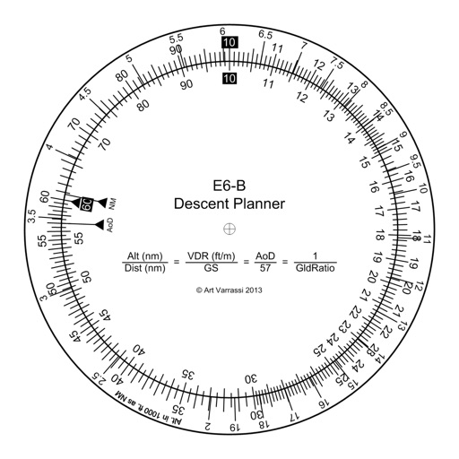
Arthur Varrassi
Circular slide rule for descent planning.
The app offers a functional circular slide rule for descent planning. It calculates top of descent distance, angle, rate, glide ratio, and maximum glide distance.

Rihab Mehboob
Navigate with real-time GPS map
View real-time GPS maps and switch between map and views by holding the device. Track heading, , altitude, latitude, longitude, speed, and temperature. Use a for accurate navigation and monitor speedometer and temperature readings.

Air Navigation SA
Plan flights, track routes, navigate skies
Plan and navigate using an interactive moving map with aeronautical charts, satellite, or vector map backgrounds. View real-time flight data, track position, and adjust routes. Access up-to-date weather and airspace information.

Daniel Medeiros
Track location and weather data
Tracks location, speed, altitude, heading, acceleration, g-force, and atmospheric pressure. Displays and records current weather. Plays back tracks at multiple speeds. Provides suggested routes for reference. Allows pausing and resuming tracking.

美霞 熊
Track location with GPS and weather data
Display , latitude, altitude, and GPS speed. Show real-time weather, pressure, and wind direction. Track location with GPS and mobile sensors. View geographical data for accurate positioning.

MATRIKS GRUP, TOV
Track speed, get alerts, view speed limits
Display speed limits and alert for overspeeding. Show speed camera locations and distance. Provide average and maximum speed tracking. Include odometer and unit selection for KMH/MPH. Display current road name, weather conditions, and temperature.

Apps are ranked by functional similarity, category fit, rating confidence, and popularity.