Monitor speed and distance with real-time GPS tracking. Switch between car and bike cyclometer. View average and max speed. Adjust units to mph or km/h. Check GPS accuracy and distance precision. Track time elapsed and altitude.
Track distance, pace, elevation gain and loss, calories, and split times during walks or runs. Set goals and view progress charts. Syncs with Apple Health. Includes an AI coach for motivation during workouts.
View current speed with a scalable . Track total distance and trip data including max and average speed. Export trip data as GPX, CSV, or KML files. Receive alerts when speed exceeds or falls below set limits.
Track location in real-time using GPS. View maps and save travel routes. Record details including speed, distance, and altitude. Share location with others. Set waypoints and receive turn-by-turn navigation. Sync data across devices.
Track progress through a roadbook with symbols. Display current track totals and average speed over time or distance. Monitor distance and speed in kilometers or miles.
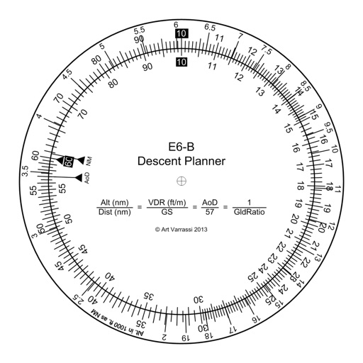
The app offers a functional circular slide rule for descent planning. It calculates top of descent distance, angle, rate, glide ratio, and maximum glide distance.
Find Black-owned businesses nearby with filters for category, distance, and ratings. View verified profiles, read reviews, and get directions. Scan QR codes to earn points, redeem rewards, and access exclusive discounts.
Track trips with real-time GPS data including speed, position, distance, elevation, and map display. Record details and export GPX files for review in Google Earth. Sync data to a computer for geo-tagging and management.
Convert spoken words into large, readable in real time. Support two-way communication between users. Allow users to send and receive messages. Enable customization of size and font. Share messages via email or social media.
Measure distances using GNSS for outdoor surveys. Track and view results on iOS maps. Share tracking data via file sharing. Adjust units to meters, feet, or U.S. survey feet. Select distance calculation methods. Remove ads with in- purchase.
Send messages with . Tap to send a sticker. Hold to position it over a message bubble. Use two fingers to resize, rotate, or move the sticker. Release to place it anywhere.
Access real-time subway data and detailed route maps. Find optimal transfer routes with time, cost, and distance details. Discover nearby attractions and navigate with real-time guidance. Retrieve station information and surrounding services.
The app plots areas on a map by adding landmark points or dropping pins. It calculates enclosed area and distances between points, with options to add interest points and photos.
View topographic of for hiking, camping, and outdoor activities. Choose between Base Map and Toporama sources. Download for offline use. Track location, elevation, and movement on the map.
Track personal transactions and view loyalty points. Access a virtual loyalty card for point collection and redemption. Locate participating stores for earning points. Receive special offers and manage account settings.
Plan using offline and save them to My Map. Pin points of interest with descriptions and photos. Navigate existing or to any location. Record trips and display elevation graphs. Export as .gpx files. Integrate with Garmin. Buy professional .