Plan flights with detailed aircraft profiles and radio frequency access. Calculate fuel requirements and flight times. Manage pre-flight checklists and weather data. Track in-flight performance and adjust routes as needed.
Track live air traffic with real-time updates on aircraft location, altitude, speed, and direction. Search for specific planes by identifier. View global paths and movement details. Receive instant notifications on status changes.
Calculate pressure and density altitudes, true airspeed, and mach number. Determine wind correction angle and true heading. Compute crosswind, headwind, and tailwind. Find ground speed and flight time. Calculate fuel burn and cloud base.
Track real-time positions and receive updates on status. View paths, altitudes, and speeds. Monitor family or friend flights for arrival and departure times. Set alerts for changes and airport pickups.
View and convert geographic across multiple formats and datums. Manage locations with an intuitive interface. Display current location at the intersection of two grey lines. Export in various global systems.
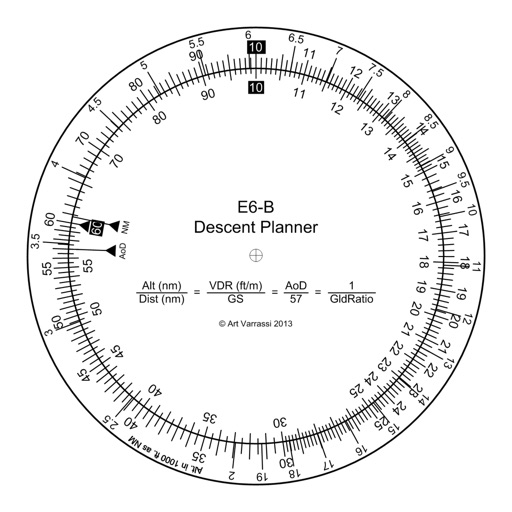
The app offers a functional circular slide rule for descent planning. It calculates top of descent distance, angle, rate, glide ratio, and maximum glide distance.
Track flights in real-time with radar maps worldwide. Identify aircraft by pointing your device at them. Monitor family and friend flights to coordinate airport meetings. View status and route details.
Calculate , headwind, and tailwind components for safe landings and takeoffs. Determine descent rates and distances for accurate navigation. Convert units between imperial and metric systems. Perform fuel burn and time en route calculations.
Perform calculations and unit conversions for aviation tasks. Access over 100 calculators with equations and graphics. Save and retrieve calculation results. Convert units for fuel, distance, speed, and weight.
Allow users to explore locations without an internet connection. They include detailed global with millions of points of interest. Users can download for use and bookmark favorite locations. GPS tracking enables recording of travel routes.
Displays current course, speed, altitude, coordinates, orientation, and weather using GPS and compass. It includes advanced bookmarking, Street View, and live Flyover mapping features.
Plan and navigate using an interactive moving map with aeronautical charts, satellite, or vector map backgrounds. View real-time flight data, track position, and adjust routes. Access up-to-date weather and airspace information.