
Compass & Altimeter
明力 王
Navigate with precise location data
Measure geographical orientation with a precise . Display longitude, latitude, altitude, weather, and magnetic field data. Record location points and view saved travel history.

Rally racing navigation instrument for motorcycles.
The app offers an adjustable odometer and a CAP heading compass on its home screen. It is suitable as a primary or backup navigation device for rally racing.
Showing 61–80 of 1,000 ranked alternatives.
明力 王
Navigate with precise location data
Measure geographical orientation with a precise . Display longitude, latitude, altitude, weather, and magnetic field data. Record location points and view saved travel history.

FOXPOI PTE. LTD.
View locations with satellite imagery
View high-definition 3D globe and latest satellite imagery. Load map tile data for detailed terrain and urban features. Use oriental compass for direction. Access historical street view for past locations. Measure area and distance on .


Via Transportation, Inc.
Book trips, share rides, go anywhere
Book trips by selecting pickup locations and destinations. Share journeys with others heading in the same direction. Match with available vehicles through an algorithm. Request rides and receive pickups at convenient spots.

Ryan Schefske
Track and location in real time
Track with GPS accuracy for driving, cycling, skiing, running, and boating. View real-time data and historical logs. Set limits and receive alerts. Export trip data and share records. Sync with fitness apps for activity tracking.

Aidana Kengbeiil
Race with real players and customize cars
Explore an open-world environment with free roaming and real-world gas stations. Race against other players in mode. Customize cars, exchange vehicles, and participate in drag racing. Use voice chat and friend lists to connect.


Applorium Ltd
Calculate distances and areas on a map
Calculates distances between map points and areas of non-overlapping polygons. Users can switch between metric and imperial units. Coordinates are displayed in decimal or degrees, minutes, and seconds.


Jan Luther
Train breath-holding for longer dives.
The app provides breath-holding training for freedivers and snorkelers. It offers a personalized plan, tracks progress, and includes four training modes.

Kawasaki Motors, Ltd.
Track vehicle data and riding logs
View vehicle data such as odometer, fuel economy, and service reminders. Track riding logs with location, date, speed, and route details. Access 3D playback and adjust electronic systems like traction control.

Craig Hunter
Navigate with compass and map
Measure distances and angles using a rangefinder and inclinometer. View GPS coordinates and map overlays. Take geo-tagged photos and videos. Use a compass and navigation calculator for orientation and route planning.

John Spinks
Locate position with UTM grid references
GPS UTM displays precise UTM grid references with 1 metre, 10 metre, and 100 metre formats. Locate position on topographic maps using global datums like ED50. Share coordinates with other apps or users.


Evgen Bodunov
Navigate with offline and GPS tracking
Provide offline with detailed points of interest. Record GPS tracks and bookmark locations. Receive turn-by-turn navigation with voice instructions in nine languages. Choose routing options for driving, cycling, walking, or shortest distance.

Zipo Apps Ltd.
Find towers and track strength
Navigate to cell towers using a built-in compass. View precise locations and details. Plan travel routes based on strength. Troubleshoot weak signals by identifying nearby towers. Optimize mobile setup with insights.
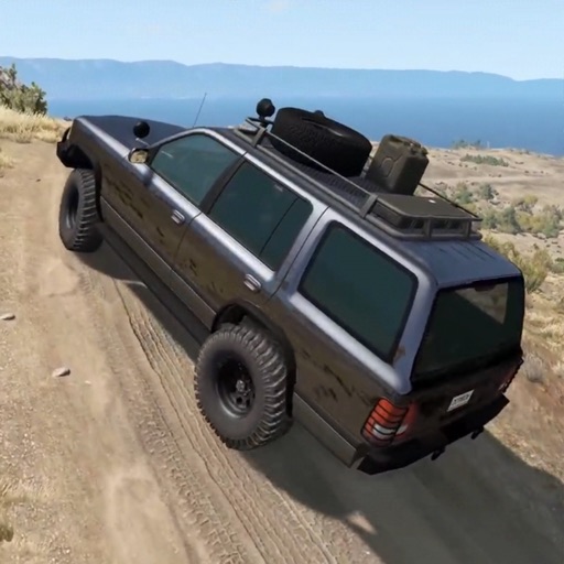
BUBU SOFT SRL
Drive jeeps and suvs through extreme terrain
Drive vehicles based on real physics with realistic 4x4 off-road simulation. Navigate through mud, snow, and water environments. Customize trucks and explore large maps. Compete in racing challenges and adjust vehicle settings for different terrains.

Apps are ranked by functional similarity, category fit, rating confidence, and popularity.