
Earth Maps
View locations with satellite imagery
FOXPOI PTE. LTD.
iPhone Screenshots
iPad Screenshots


Description
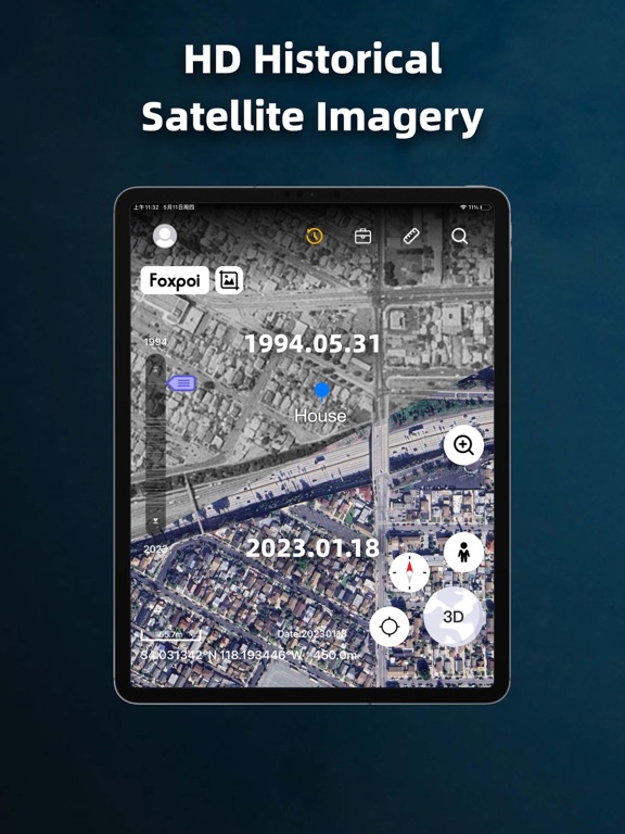
View high-definition 3D globe and latest satellite imagery. Load map tile data for detailed terrain and urban features. Use oriental compass for direction. Access historical street view for past locations. Measure area and distance on .
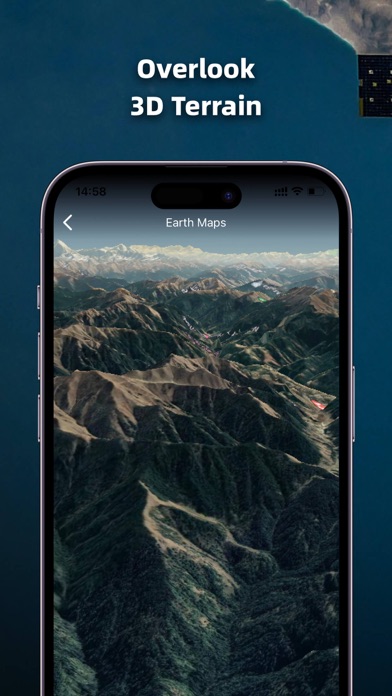
1. High-definition 3D globe
2. Load map tile data
3. Oriental compass function
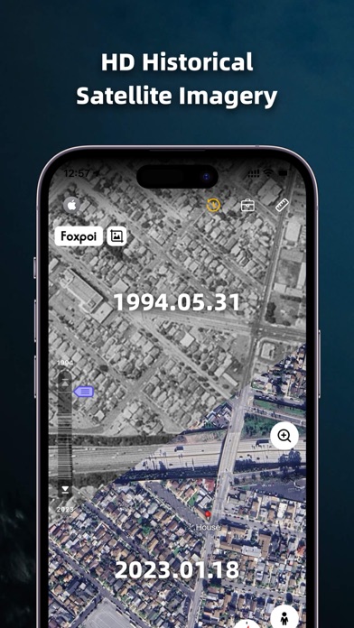
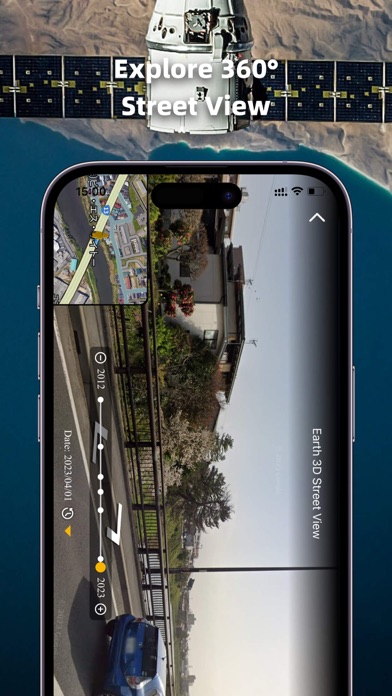
4.historical street view
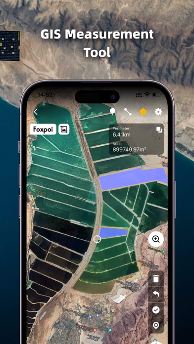
5.Measuring area distance
6.latest satellite imagery
World Satellite Map allows you to view any place on Earth using photos taken from satellites. The advantage of the world satellite map over other maps is that the satellite map allows you to consider the surface terrain, forests, rivers, lakes, buildings, roads in sufficient detail with a high degree of detail. With satellite maps, you can travel the world online without leaving your phone.
From world satellite map.
App information from Apple App Store. Earth Maps and related trademarks belong to FOXPOI PTE. LTD..