View interactive maps of any city without an internet connection. Download maps for specific locations while online. Navigate streets, search for points of interest, and access map details .
by Infinite Loop Development Ltd★ 0.00 ratingsNavigation$1.99Data updated 2026-09-08
Navigate parks with offline maps featuring trails, campsites, attractions, and points of interest. Overlay maps for easy navigation. Access trail details and facilities without internet connection.
Provides offline maps of the entire United States. Displays roads, terrain, streams, lakes, and landmarks. Works without cell signal. Allows zooming and panning. Includes compass and scale. Supports saving and sharing map views.
Explore locations with augmented reality overlays. Access offline maps for zoomable regional navigation. View interactive points of interest including public transport, restaurants, and museums. Find shopping guides, nightlife options, and city tips.
Explore self-guided walking tours of the city with detailed maps and route guidance. Locate attractions, hidden gems, and key points of interest. Navigate using turn-by-turn directions and track your progress along each tour.
Explore self-guided walking tours of the city with detailed maps and routes to popular attractions and hidden spots. Navigate using an interactive map to find points of interest. Track your progress and discover new locations at your own pace.
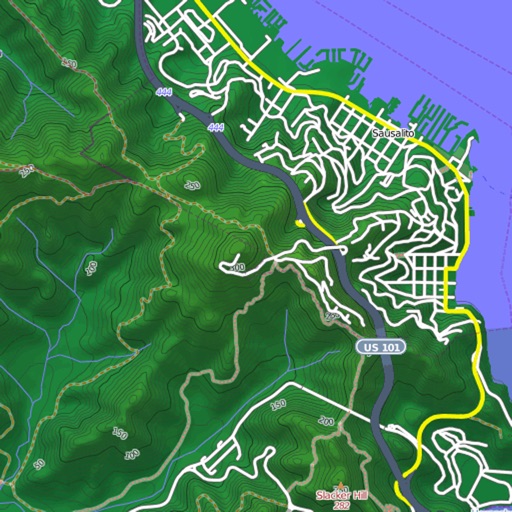
View and download detailed maps with topographical hillshading and contour lines. Store maps for offline use. Navigate using detailed terrain features. Find hiking trails, ski runs, and back streets.
Explore city streets with self-guided walking tours covering famous landmarks and hidden spots. Use an interactive map to navigate, find points of interest, and track your route. Save favorite locations and receive turn-by-turn directions.
Find the nearest station using GPS. View detailed and subway routes with transfer options. Explore stations by name or line. See high-resolution maps and line sequences for clear navigation. Plan trips with real-time route guidance.
Explore , discover landmarks, navigate city streets
Explore cities with self-guided walking tours featuring popular attractions and lesser-known spots. Navigate using a detailed city map to find points of interest.
Plan trips with offline maps, detailed directions, and attraction listings. Access insider tips and user-generated content. Book and read restaurant reviews. Sync with Apple Health for fitness tracking.
Access offline maps for , Cannes, Monaco, and the Côte d'Azur region with zoom functionality. View interactive points of interest including public transport, restaurants, and museums.
Access real-time navigation with maps and AR features. Locate points of interest like transit stops, restaurants, and hospitals. View daily itineraries and budget-friendly accommodations.
The app provides a 100% offline travel guide with zoomable regional maps of Guangzhou, Shenzhen, and Hong Kong. It includes interactive points of interest, daily itineraries, and city tips for moving around, shopping, and nightlife.
Access real-time navigation with GPS and zoomable offline maps of St. , Peterhof, and Tsarskoye Selo. View interactive points of interest including public transport, restaurants, and museums.
Explore cities with self-guided walking tours featuring popular attractions and hidden spots. View detailed maps to navigate and locate points of interest. Follow audio guides to learn about locations and enhance your walking experience.
The app provides an offline travel guide with zoomable maps and augmented reality features. It includes interactive points of interest, daily itineraries, and city tips for navigating and shopping.
Plan trips detailed maps showing attractions, dining options, and park timings. Search for specific locations, view descriptions, and filter between dining and attractions.
Explore cities with augmented reality navigation and offline maps of , Częstochowa, and Oświęcim. View interactive points of interest including public transport, dining, and attractions.
Provides navigation with detailed vector maps that support zooming at any level. Includes continuous updates from OpenStreetMap. Helps avoid roaming charges by offering local map data.