

Apps Like Pilot Live Map for iPhone and iPad
Pilot Live Map screenshots
Ranked alternatives
Showing 181–200 of 1,000 ranked alternatives.


WSI Pilotbrief Optima
WSI Corporation
Retrieve weather briefings and flight routes
Access real-time weather data for flights. Create or modify flight routes. Retrieve preflight and inflight weather briefings. View enroute conditions. Share weather information with pilots. Sync with iPad for aviation-specific weather updates.


CaptainVFR
Quality Unit s.r.o.
Plan flights, track position, navigate routes
Plan and navigate flights with interactive aviation maps featuring high-resolution worldwide coverage and offline support. Track real-time GPS positions with moving maps.


Charlotte Douglas Airport
John Mollaghan
Track flight arrivals and departures
View flight arrivals and departures for . Check terminal, gate, baggage area, and flight status. Search flights by city, gate, flight number, terminal, or baggage area. Receive updates on delays or cancellations.

Genesis PRO
Aircraft Performance Group, LLC
Plan flights, track performance, access real-time data
Plan flights with real-time performance data and predictive analytics. Input aircraft details to calculate fuel consumption and optimal routes. Access weather information and regulatory data.

C182 Performance
POH Performance L.L.C.
Compute flight metrics
Calculate takeoff, landing, climb, cruise, descent, and instrument procedure for Cessna 182 and select Cessna 210 models. Include emergency glide distance with wind adjustments, hold calculations, and risk analysis tools.


SocialFlight
SalesApproach, Inc
Explore aviation events and destinations.
The app maps over 20,000 aviation events, destinations, and airport restaurants. It also offers FAA WINGS and IA renewal courses, and a FLY2WIN challenge with rewards and prizes.
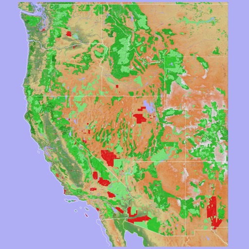
Scenic Map Western USA
Mark Granger
Explore 3D maps offline worldwide
Navigate using a 3D topographic map of the USA and Hawaii. Access offline vector maps for navigation in vehicles or outdoors. Switch to online maps for global coverage with automatic caching. Explore locations with zoom and scroll features.

FlyBy E6B
Lonnie Ganz
Calculate flight paths and fuel burn
Calculate flight performance with wind and density altitude inputs. Perform fuel burn calculations and determine true airspeed. Convert units and view flight path diagrams. Save and share flight plans.


Passngr – Make it your flight
Flughafen Muenchen GmbH
Track flights and access airport info
Access real-time information and airport maps for Munich, Frankfurt, Münster Osnabrück, and Düsseldorf airports. Find gate locations, boarding times, and service points. Receive updates on delays and cancellations.

How we rank alternatives
Apps are ranked by functional similarity, category fit, rating confidence, and popularity.