
Apps Like E6B Max: Flight Computer for iPhone and iPad
E6B Max: Flight Computer screenshots
Ranked alternatives
Showing 21–40 of 1,000 ranked alternatives.

GPS Map Camera: Geo Photos
Chirag Gabani
Capture with GPS, date, time, and location
Add GPS data including date, time, latitude, longitude, altitude, weather, and compass to . Share geotagged images with friends to show travel locations. Track live location and embed it into captured .

SkyDemon
Divelements Limited
Plan flights and navigate in real-time
Plan flights with vector charts, dynamic airspace clipping, and customizable map layers. Create routes by selecting waypoints and adjusting paths. View real-time radar data for situational awareness during flights.

ForeFlight Mobile EFB
ForeFlight, LLC
Plan flights, check weather, track position
Weather "View current conditions, forecasts, and radar maps. Set location-based alerts. Customize notifications for severe weather. Share forecasts with others."
E6B Descent Planner
Arthur Varrassi
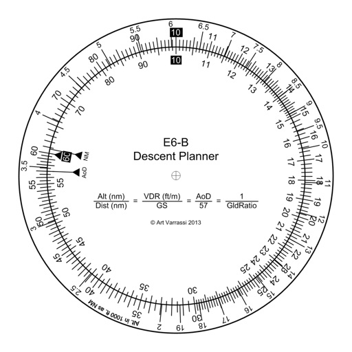
Circular slide rule for descent planning.
The app offers a functional circular slide rule for descent planning. It calculates top of descent distance, angle, rate, glide ratio, and maximum glide distance.

Sirius Navigator
Oleg Baev
Navigate with true north and altitude data
Displays magnetic and true north directions. It shows location, altitude, and barometric pressure data. Users can adjust phone light settings.

FlyQ+ EFB
APG Avionics, LLC
Navigate with glide ring and weather briefing
Provides flight data management with downloadable weather briefings and dual data cycle support. It includes a glide ring for descent planning and a collapsible navlog for airway and procedure tracking.

CaptainVFR
Quality Unit s.r.o.
Plan flights, track position, navigate routes
Plan and navigate flights with interactive aviation maps featuring high-resolution worldwide coverage and offline support. Track real-time GPS positions with moving maps.


Speedometer 55 GPS Speed & HUD
Stanislav Dvoychenko
Set limits and get alerts
Monitor with real-time updates. Set configurable limits with four presets. Alert with color change and sound when exceeding limits. Emit loud sound for speeding alerts. Track during driving. S.O.S. mode for flat tyre emergencies.

Garmin Pilot
Digital Cyclone
Track weather and plan flights
Plan flights with detailed route mapping, weather data, and fuel calculations. Access real-time weather briefings and interactive charts. Log flight details and manage preflight checklists. Sync with avionics for consistent navigation.

Travel Altimeter & Elevation
BranchenKing Ltd.
Track altitude changes with a barometer
Track changes using a barometer and set reference pressure and altitude. View real-time altitude and adjust landscapes based on time of day. Use compass for orientation during hiking and outdoor activities. Compare differences between two points.

Speedometer Speed Box Trip Log
Hans Schneider
Track , distance, and direction
Track , distance, and direction with a digital and analog . Set custom distance values. Switch between portrait and landscape modes. Display in MPH, KM/H, and KNOTS. View altitude, maximum , and average with the Pro Pack.

Planes Live - Flight Tracker
Mosaic S.r.l.
Track flights in real time worldwide
Track real-time positions and receive updates on status. View paths, altitudes, and speeds. Monitor family or friend flights for arrival and departure times. Set alerts for changes and airport pickups.

Gauges: Speedometer & Sensors
Boluga Limited
Track speed, altitude, and barometric pressure
Provides GPS altitude and pressure altitude readings. Displays speed in kph, mph, and knots. Measures barometric pressure in multiple units. Tracks acceleration in G forces. Shows location, magnetic, and true heading.

Speedometer ⊲
Unicom TOV
Track speed, distance, and altitude
GPS tracks current speed, distance, and altitude. Displays average and maximum speed. Shows speed limits in real time. Supports mph, km/h, and knots. Measures travel time and battery level. Works offline.

Speedmeter +
Unicom TOV
Track speed and distance offline
Track speed and distance in miles and kilometers. Monitor real-time speed and display maximum and average speeds. Check speed limits and receive warnings for speed and red light cameras. Access offline maps and view weather conditions.

WX Aviation Weather
Imre Virag
Track and decode reports
Access real-time data including METAR, TAF, and NOTAM reports for 50,000+ airports. View satellite maps and decoded information. Filter nearby airports by runway length and METAR/VFR availability. Save favorites and organize into groups.

How we rank alternatives
Apps are ranked by functional similarity, category fit, rating confidence, and popularity.