

Apps Like GPS Fields Area Measure Map + for iPhone and iPad
Ranked alternatives
Showing 141–160 of 1,000 ranked alternatives.

Ruler, level, tape measure
Elard Tissot
Objects with AR precision
Objects using an augmented reality camera interface. Select units like inches, feet, centimeters, or meters. Capture and save measurements. Share results via email or messaging. Sync measurements across devices.

Camera Measure - PartoMeter
VisTech.Projects LLC
Objects with your phone
Object dimensions using phone and reference objects like credit cards or DVDs. Snap photos for accurate in-plane measurements. Add custom reference objects with known sizes. Export measurement data for later review.


Square Footage Calculator +
Phan Nhat Đang
Calculate area and estimate material costs
Calculate area for , rectangular, triangular, circular, trapezoidal, or elliptical spaces. Input dimensions to get feet, meters, or yards. Estimate material costs based on price per 100 units. Export results for project planning.

Area Measure & GIS GPS GMapper
Suphawadee Yaprasat
Map, , and manage land areas
Land measurement tools allow precise and distance calculations on maps. Coordinate capture enables adding multiple coordinates to maps. Map exploration includes zooming, panning, and layer management.



Pupillary Distance Measure X
VisTech.Projects LLC
PD with your iPhone camera
By facing the camera and tapping a button. Display PD results for ordering eyeglasses or adjusting VR headsets. Supports iPhone X and newer devices.


MyMeasure
Pendlebury Software LLC
Measure map features quickly and easily.
The app measures length, perimeter, and area on a map using an interactive crosshair. Users can trace map features, and dimensions update continuously.

EasyMeasure AR
Caramba App Development
Measure spaces with AR precision
Measure objects using AR by aiming your camera and dragging a virtual ruler. Calculate height, width, length, and area. View real-time measurements and save results for later reference.


Land Measure Pro
Pendlebury Software LLC
Area, length, and angles on maps
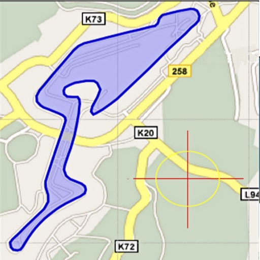
Area, lengths, and angles on maps using an interactive crosshair. Trace outlines to create connected points, updating area and perimeter in real time. Adjust radius for scaling features. View dynamic length and angle as you move the crosshair.
How we rank alternatives
Apps are ranked by functional similarity, category fit, rating confidence, and popularity.