

Apps Like GeoPulse: GPS Visualizer Pro for iPhone and iPad
GeoPulse: GPS Visualizer Pro screenshots
Ranked alternatives
Showing 161–180 of 1,000 ranked alternatives.

Altimeter - i
EONSOFT
Track altitude, max, and min elevation
Display current, maximum, and minimum altitude using GPS. Switch between meters, feet, and yards. Adjust scale increments of 10, 100, 1000, or 10000. Track altitude changes during hiking or travel.

Speedometer mph Odometer
SHIGETO TAKAGI
Track speed and distance with GPS
Displays speed and distance using GPS. Tracks maximum speed with vibration alerts. Shows position and time of maximum speed on a map. Switches between light and dark modes. Notifies of GPS measurement errors. Supports motorcycles, cars, and planes.

Virtual Cockpit
Fidel Eduardo Lopez Mayorga
Record vehicle travel data application.
The app records vehicle travel data, displaying real-time measurements like speed, distance, and altitude. It offers features such as trip recording, customizable themes, speed limit alerts, and HUD mode.

GPS Real-time Altitude Meter
海英 王
Track and air pressure in real time
Monitor , air pressure, and oxygen levels in real time using GPS and sensor data. Customize theme and background. Track environmental changes with precise measurements and dynamic updates.





Vehicle Clinometer
Sean Flanagan
Display roll and pitch gauges.
The app displays a clinometer, also known as a tilt meter, using the device's accelerometers. It shows Roll and Pitch gauges, with options for compass display, magnetic or GPS heading, and adjustable alert sounds.
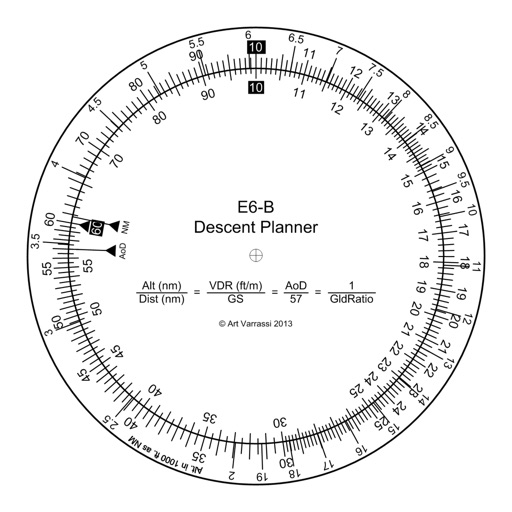
E6B Descent Planner
Arthur Varrassi
Circular slide rule for descent planning.
The app offers a functional circular slide rule for descent planning. It calculates top of descent distance, angle, rate, glide ratio, and maximum glide distance.


AirLab: Air Density & Altitude
BALLISTIC SOLUTIONS RESEARCH & DEVELOPMENT SOFTWARE SIARHEI RAICHONAK
Calculate air and
Calculate air and using weather data from OpenWeatherMap, MET Meteorologisk Institute, and Amazon. Access GPS and barometer for accurate readings. Retrieve weather data via Bluetooth.

WingX®
Hilton Software LLC
Navigate with real-time flight data
Navigation provides access to aeronautical charts including VFR Sectionals, IFR Enroute Low and High, TACs, Flyway, and IAPs. Users can view synthetic vision and fuel prices. Subscription includes advanced IFR data and APDs. Free trial available.


Altimeter Pro GR
Dimitris Papadopoulos
Altitude and context at a glance.
The app shows current altitude, latitude, longitude, and heading. It also provides weather data including temperature and atmospheric pressure.

GPS Diagnostic: Satellite Test
David Ryall
GPS, track location, diagnose issues
Provides GPS navigation with fast lock time and precise parameters. Supports multiple systems including GPS, Galileo, GLONASS, and QZSS. Diagnoses location issues and suggests fixes. Includes latitude, longitude, and WGS84 by default.


GPS Field Area Measure on Map
Anastasiia Kulias
Land areas with GPS
Calculate land using GPS coordinates. Draw shapes on maps to fields or plots. Add GPS stamps to photos with location, time, weather, and compass data. View live maps and magnetic information.

AvPlan EFB
BJA Consulting Pty Ltd
Navigate, plan, and fly with precision
Plan flights with terrain warning, restricted airspace status, and IFR airway planning. View geo-referenced taxi and approach diagrams. Manage flight data, check weather, and access navigation charts.
How we rank alternatives
Apps are ranked by functional similarity, category fit, rating confidence, and popularity.