

Apps Like FlipSide Earth for iPhone and iPad
Ranked alternatives
Showing 301–320 of 1,000 ranked alternatives.

German States: Geography Quiz
Evgenii Viushkov
Study with maps and flags
Learn about Germany's 16 federal states with maps, emblems, and capitals. Test knowledge through modes including map identification, emblem recognition, and capital guessing. Study information in a tabular format for organized review.


Earth 3D - World Atlas
Igor Panichev
Explore Earth's wonders interactively.
The app presents an interactive 3D globe with political and physical maps, showcasing over 2,600 geographic objects and 500 wonders. It includes a day/night cycle, time zones, and global weather information.


Geology Toolkit: AI Rock ID
Laurence Wayne
Identify rocks and get insights
Identify rocks and minerals by uploading photos. Get detailed descriptions of composition, texture, and origin. Explore geological insights about formations and their environments.

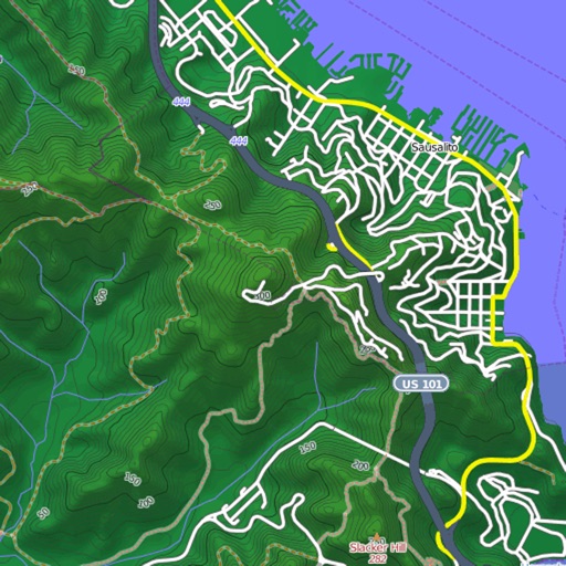
Mapster
Syzygy Research & Technology Ltd.
View maps, download trails, store routes
View and download detailed maps with topographical hillshading and contour lines. Store maps for offline use. Navigate using detailed terrain features. Find hiking trails, ski runs, and back streets.


DIY Solar System
University of California, Berkeley's Lawrence Hall of Science
Explore planets, track orbits, build models
Explore the with interactive activities like designing a Moon base and growing plants in space. Learn about planetary features, space travel, and life in space. Track celestial movements and conduct experiments to understand astronomy concepts.

Handy GPS lite
Anthony Dunk
Track routes, record trails, and return safely
View current location in UTM or lat/lon formats. Record and save waypoints. Track movement with up to 40 tracklog points. Navigate using GPS for hiking, mountain biking, and kayaking. Switch between coordinate systems. Store up to 3 waypoints.



Maine Lakes - GPS fishing maps
Flytomap
Navigate with marine and outdoor
Navigate with marine and outdoor offline. Overlay satellite and terrain data on charts. Access local weather forecasts. View worldwide and satellite imagery when connected. Use NOAA raster data for detailed navigation.


Nautical Calculator Pro
Giacomo Gabriele
Calculate routes and track positions
Calculate routes and determine points on Rhumb Line, Great Circle, and WGS84. Compute average speed and estimated time of arrival. Plan routes with manual waypoints and create waypoint routes. Support composite sailing calculations.

How we rank alternatives
Apps are ranked by functional similarity, category fit, rating confidence, and popularity.