Navigate using terrain-aware offline maps and star navigation. Access on-device AI for guidance without internet. Communicate via offline Wifi/Bluetooth Mesh for peer-to-peer coordination.
by ANDESMAYA LLC★ 5.02 ratingsNavigationFreeData updated 2026-09-06
The app provides an offline travel guide with interactive maps and augmented reality features. It includes daily itineraries, budget-based recommendations, and city tips for navigation and safety.
Plan routes with detailed directions, travel time, and fare info. Access accurate metro maps and real-time updates. Use offline mode for no internet. Switch between 11 languages. View metro info for 53 cities including Beijing, Shanghai, and .
Use augmented reality for navigation. Access maps of Tuscany regions. View interactive points of interest with public transport and services. Explore daily itineraries and budget-friendly accommodations.
Navigate with turn-by-turn directions and offline maps
Plan routes for commutes, rides, or tours using turn-by-turn navigation and offline maps. Select quiet lanes and traffic-free cycleways. View scenic roads and save routes for later.
View maps for Madrid, , and Bilbao offline. Use AR mode to navigate. Zoom and pan with touch gestures. Display user location. Fullscreen map with one tap. Subscription required for full features.
Share real-time location updates with and friends. Set up custom safety zones and receive alerts when locations change. Navigate using turn-by-turn directions and view maps. Enable battery-saving mode to extend device life.
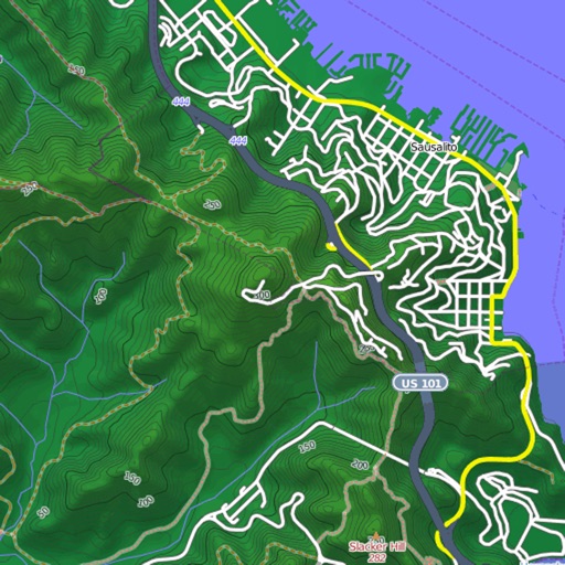
View and download detailed maps with topographical hillshading and contour lines. Store maps for offline use. Navigate using detailed terrain features. Find hiking trails, ski runs, and back streets.
The app offers an offline travel guide with augmented reality features for discovering the city. It includes interactive offline maps, daily itineraries, and information on attractions, dining, and nightlife.
Navigate with detailed vector maps that support zooming at any level. Find locations and points of interest. Avoid roaming charges by using the without internet. Track your position and explore areas without data usage.
View subway maps for , Changchun, Changsha, and other cities. Zoom in with double clicks. Move map with one finger slide. Fullscreen view with one click. Navigate stations and routes. Check schedules and transfers. Save maps for offline use.
Navigate with real-time guidance and location discovery
Navigate using step-by-step audio guidance. Find nearby locations and services. Access real-time traffic and pedestrian crosswalk information. Control the cane via the . Set destination and receive turn-by-turn directions.
Use device as high-performance GPS receiver with USA Raster Nautical . Access without cell signal. Navigate safely in emergencies. Sync with chart plotter if available. Download for offline use. Track location and display real-time data.
The app provides an offline travel guide with interactive maps and augmented reality features. It includes daily itineraries, budget-based recommendations, and city tips for Milan and surrounding regions.
Explore cities with augmented reality navigation and interactive points of interest. Access offline maps, metro guides, and zoomable regional views. Find budget hotels, restaurants, and shops. View daily itineraries and nightlife options.
Explore outdoor routes and points of interest with layered maps. View IGN maps, aerial photos, and OpenStreetMap for hiking and . Access Spain and Swiss maps, emergency call coverage in France, and winter trail information.
Access real-time location tracking and search for destinations within Seoul. Use maps for navigation without internet. View maps with route details and locate nearby stations. Switch between English, Chinese, Japanese, and Korean language options.