
Compass & Altimeter
明力 王
Navigate with precise location data
Measure geographical orientation with a precise . Display longitude, latitude, altitude, weather, and magnetic field data. Record location points and view saved travel history.

Showing 41–60 of 1,000 ranked alternatives.
明力 王
Navigate with precise location data
Measure geographical orientation with a precise . Display longitude, latitude, altitude, weather, and magnetic field data. Record location points and view saved travel history.

DOUBLE U s.r.o.
Navigate with precision and style
Provide accurate GPS coordinates and altitude readings. Display direction and map integration. Enable location-based reminders and track movement routes. Adjust settings for different navigation modes.

FFZ srl
Track altitude and record position data
Displays altitude using a digital readout and an analog gauge. Tracks maximum height reached during use. Shows altitude accuracy and sensor quality. Utilizes GPS and barometric sensor for precise measurements.



dataWorks GmbH
Navigate with altitude and accuracy
Displays altitude, coordinates, and speed with options for metric or imperial units. Shows accuracy and warns about signal issues. Offers aircraft mode with in feet. Compares current altitude with known values. No ads or data collection.


DOUBLE U s.r.o.
Track speed, distance, and trip stats
Monitor trip data with live metrics like average speed, current speed, top speed, distance, direction, travel time, stationary time, and clock. Customize display style and speed units. Arrange metrics on screen.

Rounded Peak Studios LLC
Track , altitude, and distance
View current in mph, km/h, knots, and other units. Display altitude above sea level. Track max and altitude during trips. Monitor distance traveled in trips. Check on Apple Watch. Pro upgrade unlocks custom colors, HUD mode, and ad removal.

WATT APPS LTD
Track speed with GPS and compass
Track speed using GPS with options for mph, km/h, and knots. Display city name and compass if enabled. Show traveled distance and optional average and maximum speed. Choose from multiple interface colors. Record speed during trips.

Mosaic S.r.l.
Track flights in real time worldwide
Track real-time positions and receive updates on status. View paths, altitudes, and speeds. Monitor family or friend flights for arrival and departure times. Set alerts for changes and airport pickups.

伟 雷
Navigate with real-time coordinates and altitude
Display current direction, altitude, latitude, and longitude. Show real-time barometric pressure and movement speed. Track geographic location. Switch between "Classic" and "Sunset" visual themes with premium color schemes.


BITHAUS.TECH, UNIPESSOAL LDA
Track speed with real-time GPS
Track speed, distance, altitude, and heading with real-time GPS data. Record trips with route tracking and save journeys for later. View live maps with position updates. Export trip data for analysis.


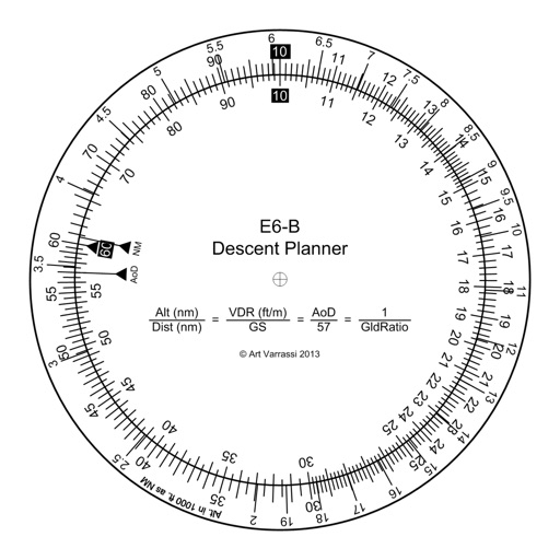
Arthur Varrassi
Circular slide rule for descent planning.
The app offers a functional circular slide rule for descent planning. It calculates top of descent distance, angle, rate, glide ratio, and maximum glide distance.

Arnau Egea
Offline altimeter for outdoor activities.
The app displays geographic coordinates and current elevation. It records the highest altitude reached and shows altitude in meters and feet.


Unicom TOV
Track speed, limits, and weather
Display current speed using GPS and show speed limits via online checks. Alert when exceeding speed limits. Track weather, temperature, odometer, altitude, and average/max speed.
Apps are ranked by functional similarity, category fit, rating confidence, and popularity.