Explore locations with 360° panoramic views. Navigate using photo spheres and photo paths. Access for detailed surroundings. Share and save panoramic images. Sync with maps for real-time navigation.
Mark locations on maps by pinning or entering GPS coordinates. Organize saved places into folders and access favorite spots quickly. Navigate using integrated Google Maps or preferred mapping services.
Book rides with on-demand pickups and drop-offs at selected locations. View real-time vehicle locations and estimated arrival times. Pay using stored payment methods and receive confirmation via notifications.
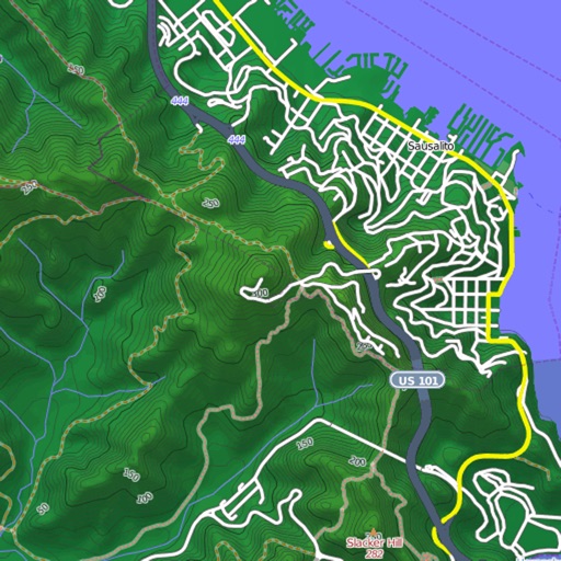
View and download detailed maps with topographical hillshading and contour lines. Store maps for offline use. Navigate using detailed terrain features. Find hiking trails, ski runs, and back streets.
Navigate trails and routes using detailed and turn-by-turn directions. Track location and elevation. Save favorite spots and share routes. Import GPX files and set waypoints. View terrain and land features for outdoor exploration.
Record cycling rides with offline maps and GPS tracking. Add routes via GPX files or existing rides. Overlay routes on maps. View climb categories and ride history without internet. Import photos and attach to rides. Sync with Health .
Tracks location, speed, altitude, heading, acceleration, g-force, and atmospheric pressure. Displays and records current weather. Plays back tracks at multiple speeds. Provides suggested routes for reference. Allows pausing and resuming tracking.
Display speedometer in digital or HUD mode with compass, odometer, and distance traveled. Show trip information including driving score based on acceleration. Track eco-driving metrics and weather data.
The app helps motorhome, van, and caravan travelers find and access secure, equipped areas 24/7. It features an interactive map, smart filters, a search engine, and traveler reviews for over 600 areas in Europe.
View real-time satellite imagery of any location. Explore 3D terrain and interactive street views. Track location and receive traffic updates. Navigate with detailed maps and location-based information.
Explore landscapes with detailed maps and points of interest. Find hiking trails, waterfalls, and historic sites. Discover local events and restaurants. Get real-time traffic and road conditions. Plan routes and save favorite locations.
Navigate Lake Norman with maps showing marinas, boat launches, restaurants, and other points of interest. Save favorite locations for quick access. Create custom places on the map for specific activities like boating or relaxation.
Plan journeys with live departures and map-based bus stop exploration. Check fares for planned trips. Purchase mobile tickets via Apple Pay or card and display them onboarding. Pay on the bus without needing cash.