

Apps Like Flight Mode Map for iPhone and iPad
Flight Mode Map screenshots
Ranked alternatives
Showing 141–160 of 1,000 ranked alternatives.


HIA Qatar
Hamad International Airport
Navigate airport terminals and gates
Navigate the airport using an interactive map. Access real-time flight information. View details about airport services and facilities. Locate shops and restaurants within the airport.


HS FLY
HOLY STONE TECHNOLOGY Co.,Ltd.
Fly with FPV, track GPS, control via
Control the via Wi-Fi with FPV support for real-time video and clear photo display. Enable GPS positioning and smartphone following flight. Record and view videos and photos from the drone.


OpenADSB
Steve Kuo
Track aircraft and view flight data
Track aircraft using real-time data from multiple air traffic sources. Display flight paths, altitudes, and speeds. Customize map views and set up alerts for specific aircraft. Connect to dump1090, tar1090, or Virtual Radar Server.


Kansas City Airport MCI +Radar
Renji Mathew
Track flights and manage trips easily.
The app offers live arrival and departure boards with flight tracking on a map. It provides flight status, delay, and cancellation information, along with tools to find alternate flights and a packing checklist.



Houston Airports – Official
City Of Houston
Find gates and navigate terminals
Find gates and navigate terminals with real-time directions and a blue dot locator. Check flight status for gate changes and arrival/departure times. Locate parking spots in terminal garages and ecopark lots.

Austin Airport (AUS) + Radar
Renji Mathew
Live flight tracking and Austin exploration.
The app provides live arrival and departure boards with flight tracking. It also offers a Sky Radar to track flights in real time and allows users to explore locations in and around Austin.

Flight Paths
william LINDMEIER
Visualize flights with AR
Visualize airspace using Augmented Reality. Select airports from a map, point camera at a surface, and tap to start. View 3D and animations of takeoffs and landings. Explore real-time routes above selected airports.

MuslimPilot Log
MOHAMMED AL OTAIBI
Track prayer times and flight logs
Navigation allows pilots to calculate prayer times adjusted for altitude. Import flight plans to create detailed logs. Track Fajr, Dhuhr, Asr, Maghrib, and Isha times along routes. Sync with flight data for accurate scheduling.

OzRunways EFB
OzRunways Pty. Ltd.
Aviation maps and flight publications.
The app provides aeronautical publications and aviation maps for international use. Users can see their position on maps and download documents for offline access.


Flight Buddy: Calm Flying
Sergey Laptenok
Track panic symptoms during flights
Helps users manage fear of with guided breathing exercises and relaxation techniques. Tracks progress over time. Offers educational content about mechanics. Provides in- reminders and mood tracking features.
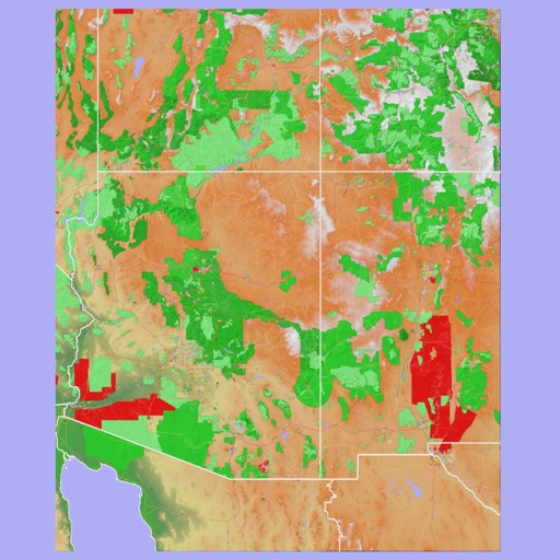
Scenic Map Grand Canyon
Mark Granger
Explore landscapes in three dimensions.
The app provides 3D topographic maps for iPad and iPhone. Vector map data is contained within the app for offline use, supporting navigation in various environments.
How we rank alternatives
Apps are ranked by functional similarity, category fit, rating confidence, and popularity.