

Apps Like Trek M for iPhone and iPad
Trek M screenshots
Ranked alternatives
Showing 101–120 of 1,000 ranked alternatives.



Relief Maps : backcountry gps
Batiste Vonderweidt
Explore 3D offline and navigate mountains
View 3D for hiking, skiing, trekking, paragliding, and mountaineering. Download and use USGS offline for navigation without internet. Track location with GPS. Display topographic data and elevation changes. Share map locations and routes.

GPSRecorder
Cyril Godefroy
Record location, track movement, geotag photos
Records position, distance, and duration during use. It tracks movement and geotags external photos. Users can review tracks on a map, view speed and distance, and export data as GPX files for other software.

Vidometer
Ramandeep Gill
Record video with telemetry data.
The app records HD video with an animated graphical overlay. It transforms the iPhone into an action camera, combining videos with telemetry data like speed, altitude, and heart rate.

GPS Speedometer - Track Speed
Bhavik Savaliya
And distance in real time
Vehicle with GPS for cars, bikes, and boats. Display in mph, km/h, and knots. Use analog ranges for different vehicle types. Monitor odometer readings for distance traveled.
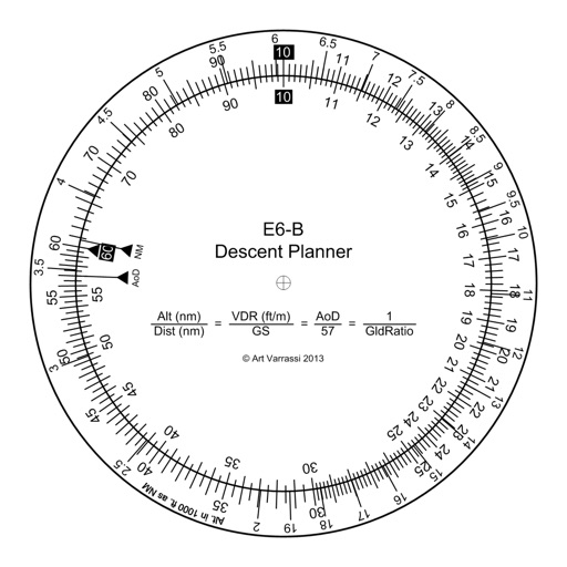
E6B Descent Planner
Arthur Varrassi
Circular slide rule for descent planning.
The app offers a functional circular slide rule for descent planning. It calculates top of descent distance, angle, rate, glide ratio, and maximum glide distance.

CycleComputer
Guillaume Fleury
Track speed, distance, and route while cycling
Track cycling performance with real-time speed, distance, and route data. Choose from digital, analog, or map displays. View ride history and manage past rides. Automatically pause timing when stationary. Swipe to switch between displays.


Speedometer mph Odometer
SHIGETO TAKAGI
Track speed and distance with GPS
Displays speed and distance using GPS. Tracks maximum speed with vibration alerts. Shows position and time of maximum speed on a map. Switches between light and dark modes. Notifies of GPS measurement errors. Supports motorcycles, cars, and planes.

Device Tracker - Mobile Finder
Parth Pandya
Track location without internet
Track location data without internet connectivity. View date-wise location history on your . Access current location to record movement. No personal data is uploaded or shared. Monitor activity logs directly from the .


bergfex: Hiking & Tracking
bergfex GmbH
Track hikes, ski tours, and outdoor routes
Find hikes or ski tours tailored to your preferences. Create and save personalized routes using the route planner. Track outdoor activities with precise GPS navigation. Access detailed maps for the Alpine region.

Chicago Subway CTA Map
敏 吴
Find routes and view maps
Offers real-time transit data and an official CTA map. Users can search routes, view transfer options, and check travel time, fare, and distance. The provides details on nearby attractions and current navigation updates.

GPSLocator: Run, Hike & Sail
Ioannis Pinakoulakis
Real-time GPS tracking for outdoor activities.
The app provides real-time GPS tracking for outdoor activities. It offers route planning, navigation, and track recording with live statistics, all while ensuring user privacy with no data collection.


HK Metro Guide - MTR Mobile
敏 吴
Navigate to sites with real-time directions
Reference "Access up-to-date transit data and maps. Search routes and transfer options with timing, cost, and distance details. Get real-time navigation and nearby station info. View service details and operate offline without internet."


GPS Speedometer HUD & Odometer
CHENGDU MIAOZHI TECHNOLOGY CO., LTD.
Track speed and journey details
Track speed, distance, altitude, and heading using GPS. View latitude and longitude coordinates. Monitor sunrise and sunset times. Record acceleration data. Save journey logs for later review. Share trip details via email or social media.
How we rank alternatives
Apps are ranked by functional similarity, category fit, rating confidence, and popularity.