Track outdoor activities like hiking, biking, walking, and running with GPS. Save and navigate to waypoints. Store favorite destinations. View activity logs and maps. Share routes and track progress.
Convert handwritten notes and whiteboard content into searchable text. Share scans directly to cloud services. Use seven-symbol shortcuts for quick file naming and organization. Enable handwriting recognition for transcription and search.
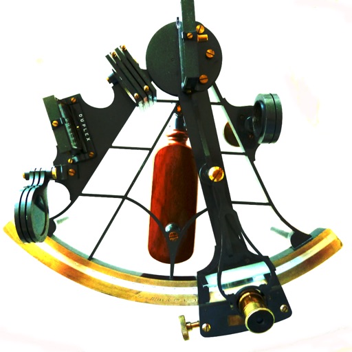
The app provides navigation computations for celestial bodies using an internal almanac. It offers solutions for position fixes, sailings, and piloting, including lunar distance and a graphical Sight Planner.
Calculate celestial navigation using the Law of Cosines method. Input Local Hour Angle, declination, and latitude to determine altitude and azimuth. Track calculations and review results for accuracy.
Navigation provides perpetual almanac and star finder chart with animation. Calculates lines of position, object data, and meridian passage. Supports running fixes and astronomical position calculations with multiple star observations.
Prepare for the U.S. with practice questions, study guides, and exam tips. Review civics topics, take practice quizzes, and track progress. Access official resources to prepare for the naturalization interview and .
Access 150+ million publication pages directly on the device. Connect with 20+ million researchers to find collaborators. Stay updated with new research through follow feeds. Track personal stats and receive weekly reports.
An interactive version of "Dr. Seuss’s ABC" with animated illustrations and sound effects. Tap images to reveal hidden surprises. Practice letter recognition and phonics through embedded learning activities.
Documents to create high-quality PDFs with automatic border detection and perspective correction. Enhance images by removing shadows and sharpening text. Extract text using OCR and export as editable files.
Access nautical charts, view tide predictions, and check weather forecasts. Locate marinas, fuel stations, and points of interest. Share real-time updates and connect with other boaters for navigation tips and safety alerts.
Provides detailed nautical maps for boating. Plan routes with a route planner. Access AIS data for vessel tracking. Locate marinas, bridges, and locks. Use offline maps for areas without internet. View almanack information for weather and tide data.
Track boat trips and navigate to destinations in North America. View real-time locations of friends. Access local knowledge from other boaters. Set and follow routes. Share trip details with others. Receive updates and alerts.
View high-resolution NOAA nautical with depth data for U.S. coasts, Great Lakes, major rivers, Brazil, and global areas. Navigate using GPS, track vessel position, and set waypoints. Access tidal information and route planning tools.
Book allows children to color pages featuring animals, vehicles, and objects. Includes interactive games to develop fine motor skills and shape recognition. Features sound effects and simple navigation for young users.
Calculate precise celestial positions using real-time data from 1900 to 2050. Input date and time to instantly recalculate GHA and declination for the Sun and Aries.
Track routes, find waypoints, and navigate offline
Navigate outdoors with offline GPS maps and real-time augmented reality. Track waypoints and custom locations. Use a gyrocompass, speedometer, altimeter, and inclinometer. Find celestial bodies and measure angles.
Access depth and marine charts for USA, Canada, UK, and other regions. Locate spots with AI-driven breakline analysis. Create or import boating routes with GPS and voice navigation. View HD bathymetry and sonar contours for precise planning.