

Apps Like Topo Maps 2 for iPhone and iPad
Topo Maps 2 screenshots
Ranked alternatives
Showing 261–280 of 1,000 ranked alternatives.

NYC Maps – Subway, Bus, & LIRR
Thryv Inc
Zoom of NYC subways, buses, and
View detailed subway, bus, and for NYC areas. Zoom in for clear details. Navigate stations and routes. Find real-time updates and service alerts. Plan trips with route suggestions. Track arrival times for buses and trains.

Maldives GPS Map Navigator
Flytomap
Explore maps without mobile coverage.
The app provides worldwide marine and outdoor maps, satellite imagery, and terrain overlays. It includes local marine weather forecasts and community information for boaters.

We Album
Makoto Katsumata
Save photos with GPS and timestamps
Save photos with GPS location and timestamp. Set names and dates. Share photos directly. Search for places and export to Photos . Includes iMessage sticker and widget for quick access.

Pro Altimeter - Barometric+GPS
Craig Hunter
Measure altitude with precision
Measure altitude using barometric pressure and GPS data. Display altitude in feet and meters with real-time accuracy. Calibrate sensor and switch between day and night display modes.

No Roads
i3 Product Development, Inc.
Map trails, record tracks, explore offline
Navigate off-road trails by dropping waypoints and recording tracks. Explore curated trails and points of interest. Receive real-time hazard alerts and trail conditions. Download maps for offline use. Access detailed weather and elevation data.


Houston Transit Metro
Bhanu Munjal
Find stops, save favorites, track vehicles, search
Find nearby stops with one click. Favorite stops for access across devices. Get real-time updates on vehicle schedules and positions. Search by stop name, number, or route. Maps are resizable for better control.

Ski Haute-Gaspésie
Avalanche Quebec
Navigate mountains and track your route
Provide detailed trail information including route names, difficulty levels, and elevation gains. Display precise topographic maps with avalanche terrain exposure ratings. Navigate through Chic-Chocs and areas.

Karttaselain - Maastokartta
AccelBit Inc.
Detailed maps for outdoor and work.
The app provides detailed maps for outdoor activities and work, including terrain, waterways, and property data. It offers features like offline maps, nautical charts, and GPS positioning for navigation.

Compass 54 Pro
Elen Bekzadyan
Real compass with location and weather.
The app displays device orientation to magnetic fields. It provides location coordinates, course, speed, altitude, weather information, date, time, and map views.


iSailGPS : NOAA USA RNC Charts
James Associates Inc.
Plot courses and track your route
Use device as high-performance GPS receiver with USA Raster Nautical . Access without cell signal. Navigate safely in emergencies. Sync with chart plotter if available. Download for offline use. Track location and display real-time data.


rakkup
Outdoor Geeks LLC
Guidebooks for climbing and skiing.
The app provides access to climbing and backcountry skiing guidebooks on a mobile device. Guidebooks are available for offline use after download and offer turn-by-turn trail navigation to climbs using the device's GPS.
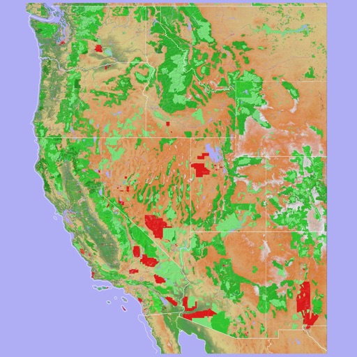
Scenic Map Western USA
Mark Granger
Explore 3D maps offline worldwide
Navigate using a 3D topographic map of the USA and Hawaii. Access offline vector maps for navigation in vehicles or outdoors. Switch to online maps for global coverage with automatic caching. Explore locations with zoom and scroll features.

Speedo - Speedometer GPS
Minh Nguyen
Track speed, view odometer, log trips
View current speed with a scalable . Track total distance and trip data including max and average speed. Export trip data as GPX, CSV, or KML files. Receive alerts when speed exceeds or falls below set limits.


Paper Maps
Abbro Inc
View , edit layers, share annotations
View PDF, TIFF, KAP, and KML files. Sync with iCloud, Google Drive, OneDrive, and Dropbox. Add placemarks, record tracks, and draw shapes. Share annotations in real time. Use tools like theodolite and georeferencer for map editing.
How we rank alternatives
Apps are ranked by functional similarity, category fit, rating confidence, and popularity.