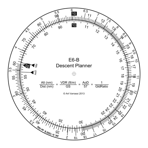
E6B Descent Planner
Arthur Varrassi
Circular slide rule for descent planning.
The app offers a functional circular slide rule for descent planning. It calculates top of descent distance, angle, rate, glide ratio, and maximum glide distance.

Showing 1–20 of 1,000 ranked alternatives.
Arthur Varrassi
Circular slide rule for descent planning.
The app offers a functional circular slide rule for descent planning. It calculates top of descent distance, angle, rate, glide ratio, and maximum glide distance.

Lonnie Ganz
Calculate flight paths and fuel burn
Calculate flight performance with wind and density altitude inputs. Perform fuel burn calculations and determine true airspeed. Convert units and view flight path diagrams. Save and share flight plans.

Flightradar24 AB
Track flights and view real-time aircraft data
Track aircraft movements in real-time on a detailed map. View details including destination, aircraft type, and altitude. Use device camera to identify planes and check status. Receive alerts for changes and delays. Share data with others.

Mosaic S.r.l.
Track flights in real time worldwide
Track real-time positions and receive updates on status. View paths, altitudes, and speeds. Monitor family or friend flights for arrival and departure times. Set alerts for changes and airport pickups.


Juan Mauricio Padilla Villarreal
Calculate ISA deviation for descent.
This utility calculates average ISA temperature deviation for descent planning. It simplifies manual calculations, reduces workload, and minimizes potential errors for pilots using the FMC.

Gonzalo Esteban Astica Capra
Manage flight data and calculate fuel burn
Navigation provides flight planning and in-flight calculations. Users can customize quick access buttons, configure units, and manage blocks and airtime.

Raj Jeshang, Inc.
Calculate flight parameters and altitudes
Calculate pressure and density altitudes, true airspeed, and mach number. Determine wind correction angle and true heading. Compute crosswind, headwind, and tailwind. Find ground speed and flight time. Calculate fuel burn and cloud base.

Polarrcan Software Inc
Edit photos and videos with AI tools
Edit photos with Retouch AI for face and skin enhancements. Apply selective adjustments to objects and masks. Use overlays and global settings for lighting, color, and effects. Export and share edited images directly.

Adventure Pilot, LLC
Affordable capability for VFR IFR pilots.
The app offers VFR and IFR pilots an affordable, capable, and usable electronic flight bag. It provides pilots with necessary information for safe flight, featuring an intuitive interface and pilot-focused support.

Aeroapps Technology, LLC
Calculate flight data with precision
Calculate groundspeed, true heading, compass heading, leg time, distance, fuel required, fuel flow, and endurance for flight planning. Convert airspeed, altitude, and temperature.

Shenzhen Xiaoruo Technology Co., Ltd.
Create thumbnails and intros for YouTube videos
Create thumbnails and intros for YouTube videos using 500+ templates. Add text with 200+ fonts and effects. Use 2000+ stickers and 500+ backgrounds. Remove photo backgrounds with AI cutout. Upgrade for advanced tools and materials.

Gonzalo Esteban Astica Capra
Calculate flight data and track position
Navigation provides flight planning and in-flight calculations. Users can customize quick access buttons, configure units, and adjust keypads. Features include real avionics look, flight data entry, and performance calculations.

Sporty's Pilot Shop
Calculate data and track position
Calculate -related conversions, fuel consumption, and navigation metrics. Perform arithmetic operations and unit conversions. Track time, distance, and speed. Sync with Apple Watch for real-time updates.

7Logic LLC
Create -by- videos
Create -by- videos with vertical and horizontal collage options. Add cool music for vlogs. Choose from popular ratios like Instagram, TikTok, and YouTube. Customize styles and adjust layouts. Share videos directly to social platforms.

pinkfroot limited
Track planes and view live air traffic
Track live air traffic with real-time updates on aircraft location, altitude, speed, and direction. Search for specific planes by identifier. View global paths and movement details. Receive instant notifications on status changes.

Fitness & Sports apps SRL
Record runs, track routes, analyze performance
Record runs with GPS tracking of speed, distance, and altitude. View saved routes on maps. Analyze performance with detailed stats and vertical movement data.

Raymond Chase
Set altitude alerts and track vertical navigation
Manage altitude with customizable VNAV settings for precise control. Set altitude alerts and use ALT HOLD mode for minimal setup. Track vertical navigation parameters and adjust flight paths accordingly.

PIXERY BILGI TEKNOLOJILERI ANONIM SIRKETI
Edit videos and photos with AI
Edit photos and videos using AI to generate artistic visuals. Apply dynamic transitions between original content and AI-enhanced effects. Share edited media directly to social platforms.
Apps are ranked by functional similarity, category fit, rating confidence, and popularity.