

Apps Like Topo Fire for iPhone and iPad
Topo Fire screenshots
Ranked alternatives
Showing 121–140 of 1,000 ranked alternatives.



Term Quotes by Topo
Insurance Experts Network LLC
Compare term life insurance rates now.
The app provides current term life insurance rates from over 20 carriers. It offers a pre-screener for underwriting issues and is available in all 50 states.

NYC Precinct Map
JC Accounting & Innovative Technologies, Inc
Know your location and boundaries
Displays real-time location and current /sector boundaries. Shows crime/incident data and sector maps. Includes satellite and street view layers. Provides quick access to contact info and navigation tools.

Great Lakes HD Nautical Charts
Flytomap
Navigate with marine and outdoor maps
Navigate with offline marine, lake, and outdoor maps. Access worldwide satellite and terrain overlays. View local weather forecasts. Use NOAA, USGS, and DRG data for detailed charting.

Minnesota Lakes Fishing Charts
Flytomap
Worldwide marine lake outdoor maps
The app provides worldwide marine, lake, and outdoor maps, satellite imagery, and terrain features. It offers local weather forecasts, tide data, and community information for boaters and fishermen.

US Metro - Washington, NYC, LA
AR Code Pte. Ltd.
Navigate subway maps offline
View subway maps for Atlanta, Baltimore, Boston, Chicago, Cleveland, Los Angeles, Miami, New York City, Philadelphia, San Francisco, and Washington. Fullscreen map with one click. Zoom using double click or two fingers. Move map with one finger.

Lokimaps
Shingle Oy
Navigate with accurate
View topographic of with detailed scale options and lake depth information. Access property data via in- purchase. Download for offline use. Navigate using precise map data and location features.

NP Maps
Delcartes LLC
Download and track your route
Download for national parks and USGS topographic regions for offline use. Access 150 NPS park and 60,000+ topographic . Use GPS navigation without internet connectivity. Save for later use in areas with no data service.

Memory-Map
Memory-Map, Inc.
Navigate with offline maps and GPS
Turn your iPhone or iPad into an outdoor GPS or marine chart plotter. Use detailed Topo maps or NOAA marine charts for navigation. Access maps offline without a network connection. View GPS location without mobile signal.

Tread®
Garmin International
Track friends, plan routes, sync maps
Track up to 20 friends on a shared map. Sync waypoints, tracks, routes, and collections across devices. Plan routes using the same maps and vehicle profiles as on the Tread device. Import and export GPX files.

Looking4Cache Pro
Michael Andreas May
Find geocaches and save details
Navigate using real-time maps and track geocaches with detailed location data. Store geocache information including logs, waypoints, and images locally. Import GPX files or pocket queries. Access over two million geocaches directly via API.

GPS Route Maps – Navigation
zohaib khaliq
Navigate with real-time traffic updates
Find locations using GPS. Get turn-by-turn voice with real-time traffic updates. Track routes and receive driving directions. View for any destination. Enable safer and faster travel with tracking and features.
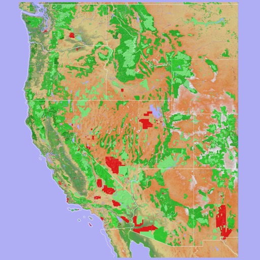
Scenic Map Western USA
Mark Granger
Explore 3D maps offline worldwide
Navigate using a 3D topographic map of the USA and Hawaii. Access offline vector maps for navigation in vehicles or outdoors. Switch to online maps for global coverage with automatic caching. Explore locations with zoom and scroll features.

Seoul Metro Subway Map
Mapway Inc.
Navigate stations and track your route
Navigate system with real-time route planning and step-by-step directions. Find nearby stations, check arrival times, and plan transfers. Tap to tap T-money card for fare payment. View maps and schedules for accurate travel information.

Garmin Explore™
Garmin International
Find locations, plan routes, navigate offline
Plan trips by streaming maps over Wi-Fi or cellular. Search for locations like trailheads or mountain peaks. Navigate outdoors using a compatible device. View maps and plan routes without requiring constant internet connectivity.

OutDoors GPS France - IGN Maps
RoadTour LLC
Find routes, track your path, download
View topographic, satellite, and road . Download official IGN for offline use. Find and follow hiking and biking routes across Europe. Record, save, and share routes online. Set waypoints and track progress. Navigate without cellular signal.

NP Maps - Yellowstone
Delcartes LLC
Explore parks and topography offline
View high-resolution NPS of and Grand Teton National Parks. Track real-time location on . Download USGS topographic for offline use. Access detailed terrain and park boundaries without internet.

SkyTrack | Live Flight Tracker
Appeclectic Ltd
Track flights, view maps, monitor arrivals
Track flights in real time with interactive maps worldwide. View departure and arrival boards for airports. Monitor flights of friends or family. Receive alerts for status changes. Share data via social media.
How we rank alternatives
Apps are ranked by functional similarity, category fit, rating confidence, and popularity.