Apps Like SkyTest Heading Trainer for iPhone and iPad
Practice compass points and degrees.
The app provides practice for tasks involving compass points and degrees. Users can customize exercises to match their understanding of compass correlations, with reference values shown in degrees or compass points.
by Aviation Media & IT GmbH★ 0.00 ratingsEducation$5.99Data updated 2026-10-11
Displays current with a large degree reading and a pointing arrow. Shows cardinal directions and a rotating rose. Includes a flashlight for low-light visibility. Provides accurate north orientation for land and marine navigation.
Provides direction and orientation for accurate prayer alignment. Displays real-time heading and angle. Includes accessibility features for visually impaired users. Allows manual adjustment of location and prayer time settings.
Displays current with large, clear indicators. Shows both true and magnetic north. Features a minimalistic interface with a prominent display. Offers free navigation without additional costs.
Display a needle indicating North and the direction from any global location. Adjust orientation manually. Show prayer times based on current location. Navigate without requiring internet connection.
Track speed using GPS with options for mph, km/h, and knots. Display city name and compass if enabled. Show traveled distance and optional average and maximum speed. Choose from multiple interface colors. Record speed during trips.
Navigate using drive and walk routes with real-time time and distance calculations. Search by address, place, or coordinates. View satellite maps and direction. Share locations, use compass, and track GPS.
View high-definition 3D globe and latest satellite imagery. Load map tile data for detailed terrain and urban features. Use oriental compass for direction. Access historical street view for past locations. Measure area and distance on .
The app transforms devices into a compass with a rustic aesthetic and user-friendly interface. It provides location, altitude, and orientation using device sensors for navigation and everyday use.
Determine with precise compass readings in degrees and cardinal points. Track real-time orientation as you move. View current coordinates and altitude. Calibrate compass for accuracy.
Calculate wind values including head/tail and using TAS input and device location. Manually enter headings if compass data is unreliable. Display reciprocal headings and tracks. Use location data temporarily for wind calculations without storage.
Displays the direction for prayer worldwide using a compass. Provides accuracy alerts for interference or low precision. Works offline and globally without requiring internet connection.
Navigate using true north calibration. View latitude and longitude coordinates. Access location and elevation data. Display compass direction and geographic position.
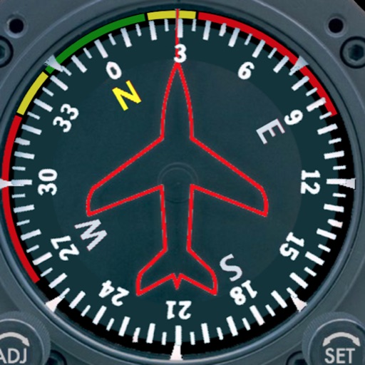
Displays a photorealistic -style indicator with both analog and digital readouts. Users can toggle rotation lock, simulate the instrument indoors, and view improved graphics. Supports latest iOS versions and includes bug fixes.
Rally racing navigation instrument for motorcycles.
The app offers an adjustable odometer and a CAP heading compass on its home screen. It is suitable as a primary or backup navigation device for rally racing.
Display a compass overlay on the map. Navigate with turn-by-turn directions. Show current speed, altitude, and heading. Indicate device orientation with a level feature.