Research property details by address, owner, PIN, or REID number. Tap the map to view building photos, deed links, real estate data, and civic service info. Access map layers for zoning, soils, greenways, and topography.
by City of Raleigh★ 4.528 ratingsProductivityFreeData updated 2026-09-08
Explore with high-resolution maps and topographic details
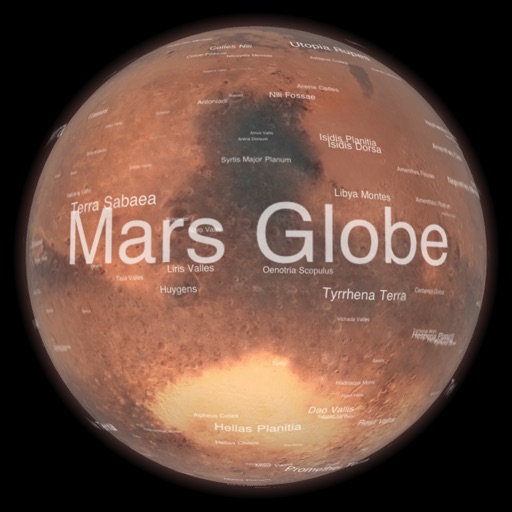
Explore a high-resolution 3D model of with topographic lighting and satellite data. Navigate the surface, view annotated features, and access information links. Take a guided tour or explore freely.
Look up with detailed state, city, and county information. View population data and locate zip code center points on maps. Find nearby , search by city, and access data without internet.
Access city services, public safety resources, parks, and recreation facilities with direct contact information and location details. View city news updates and government-related information. Navigate to important city destinations with one tap.
Manage property listings by editing prices and remarks. Search properties by address, map location, or other criteria. View hotsheet activity and market statistics. Access full listing details and stay connected with leads and clients.
Receive critical call details instantly via Apple Push notifications. Automatically map alarm locations and share real-time updates with responders. Access related photos and documents directly. Convert unclear dispatch data into readable sections.
Learn about Texas state elected with that include images and names. Swipe through cards to review , test memory with quizzes, and receive feedback on correct answers.
Track vehicles in real time, map historical routes, and view or edit vehicle properties. Set up alerts, monitor fuel usage, and generate reports for fleet management.
, Keynote, and Numbers offer 100 professional designs. Users can create annual reports, plans, and meeting agendas. include legal documents, brochures, and cards. Customize layouts and export directly to Apple apps.
The app provides real estate professionals with authorized access to property listings. It allows users to open lockboxes using a PIN or biometrics, and offers features for managing lockboxes and viewing property information.
Plan and execute drone flights with pre-programmed missions. Capture and view high-resolution aerial images and videos. nd share interactive maps, orthomosaics, and 3D models. Manage data and settings directly from the mobile device.
Navigate a 2.5-mile historical tour with GPS-guided directions. Access a directory of 17 sites with links to additional information. Share locations via social media, SMS, or email.
Control vacuum cleaner operations with start, pause, and return commands. Manage schedules and customize settings. Monitor status and receive notifications. Adjust zones and map floor plans.
View tide predictions with detailed forecasts and historical data. Access real-time weather data from over 3,300 stations. Explore interactive almanacs for future planning. Use the station map for location-based weather insights.