The app provides current FAA aviation charts updated every 28 days, including approach plates for the USA. It offers VFR, IFR, and other chart types, with METAR/TAF and IFR overlays.
by SkyCharts LLC★ 5.02 ratingsNavigationFreeData updated 2026-10-09
Track satellite passes using augmented reality. View the International Space Station, Starlink Trains, and other satellites in real time. Overlay positions on the night sky via iPhone or iPad camera.
Plan routes, share locations, and navigate off-grid
Plan and execute missions with real-time GPS navigation, coordinate teams through integrated communication tools, and manage tasks with mission-specific software. Track location, receive alerts, and access offline maps for remote operations.
Track flight delays at select US airports using FAA data. View summaries and heat maps showing current delays. Access weather information for international airports. Link to myTSA for additional travel resources.
Get real-time weather updates with current temperature, humidity, wind speed, and air pressure. View detailed forecasts for your location or any global destination. Receive alerts for severe weather conditions. Track weather trends over time.
Access vector charts, freshwater maps, and USACE river maps. Create or import routes using GPX/KML. Receive voice prompts for navigation. View tide and current predictions. Rotate charts with text remaining upright.
Track routes using GPS navigation, pause and resume routes, and view route statistics. Log finds with details like name, category, and location. Take photos of finds. Toggle between satellite, hybrid, and standard maps.
The app provides daily weather information with a clear home page and changing backgrounds. It offers current conditions, 7-day forecasts, sunrise/sunset times, radar, satellite data, and air quality information.
View detailed Swiss maps with scales from 1:10,000 to 1:1 million. Access current aerial images and historical maps. Explore hiking trails, mountains, and snow sports routes. Use offline without login or ads.
Track boats and ships in real time using a map. Identify vessels by pointing your camera at them. Receive alerts when tracked vessels depart or arrive. View vessel details and movement history. Share tracked vessels with others.
Track catches, connect with anglers, share reports
Track catches and view reports from others in your area. Connect with anglers to share tips and experiences. Access real-time buoy data and 30-day tide solunar forecasts.
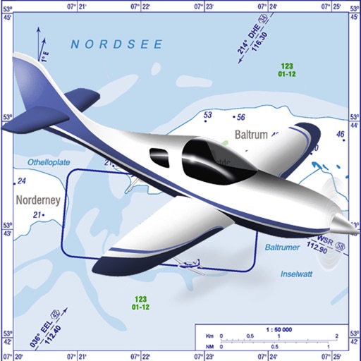
VFR charts for German airfields and helicopter sites.
The app provides VFR charts for German airfields and helicopter landing sites, including French AIP maps. Users require an account for content downloads and map updates, with monthly updates available for a fee.