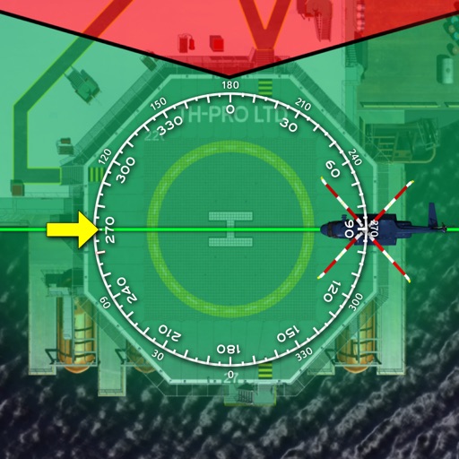
Displays current wind direction and speed, runway course, and cross, head, or tailwind components. It shows applied wind limits, forbidden wind angles, and a maximum wind speed table. Users can set up wind parameters for accurate flight evaluations.
Calculate aircraft weight and balance with load entry and limit checks. View graphical displays of center of gravity and load distribution. Export mission and manifest data via email. Access online support and documentation.
PEVIKTERA Consulting Kereskedelmi, Gazdasagi es Muszaki Tanacsado Korlatolt Felelossegu Tarsasag
Track vehicle location and manage events
Track off-road trips with real-time location updates and route mapping. Share progress with group members. Manage events and vehicle details. Access advanced features with a Pro subscription. Register to use the and sync with the website.
Track public transportation with real-time updates on departure, travel, and arrival times. Monitor multiple transit systems including buses, trolley-buses, trams, and shuttles. Search for bus stops, view schedules, and customize the map.
Access real-time data and control virtual . Tune global aviation radios or create custom radio aids. Practice navigation techniques and use as a training tool or supplementary instrument during flights.
Provides flight data management with downloadable weather briefings and dual data cycle support. It includes a glide ring for descent planning and a collapsible navlog for airway and procedure tracking.
Calculate the Great Circle between any two airports worldwide. Search by name, ICAO, or IATA code. View accurate measurements and flight path information.
Provides GPS navigation with fast lock time and precise parameters. Supports multiple systems including GPS, Galileo, GLONASS, and QZSS. Diagnoses location issues and suggests fixes. Includes latitude, longitude, and WGS84 by default.
Track flights in real-time with flight details, aircraft models, and live positions. View flight paths, altitudes, and speeds. Receive notifications for takeoffs and landings. Access historical flight data and aircraft information.
Distances between points or calculate area of locations. Draw paths on maps or tap to add points. Record movement automatically while walking, running, or cycling. Save measurements for later review.
The app allows users to fly a fighter airplane in full 3D, completing missions with machine guns, missiles, and a ray weapon. It features 45 levels with increasing difficulty and various camera perspectives.