Remotely view and control Raymarine e,c,ES, and Axiom MFDs via iPad. Access electronic charting, sonar, radar, and thermal night vision. Emulates MFD functions for remote operation. Requires MFD software v3.15 or later and WiFi-enabled displays.
by Raymarine UK Limited★ 3.37 ratingsNavigationFreeData updated 2026-09-08
Monitors boat position and vital systems in real time. Sends alerts for unexpected changes. Integrates with Boat Monitor. Allows remote access to system data. Provides security and comfort features for boat owners.
Displays a 24-hour analog with a sweeping second hand. It shows GPS coordinates, heading, and compass bearing based on device orientation. It uses location data in the foreground without saving or transmitting personal information.
The app displays device orientation to magnetic fields. It provides location coordinates, course, speed, altitude, weather information, date, time, and map views.
View real-time locations and service updates. Track train arrivals and departures. Check station access points and transfer options. Reroute for current service changes. Share map data with other users.
The app displays audio and visual signals from the AL Priority Multipurpose Laser System via Bluetooth. It provides laser and radar alerts, identifies laser sources, and logs encounters with details like speed and type.
The app provides estimated bus arrival times and routes for public buses in Singapore. It displays bus capacity, estimated bus locations on a map, and allows users to find nearby bus stops and save frequent services.
Measure distances by dragging a finger across the map to calculate route lengths. Center on current location with the locator button. Clear routes by shaking, using the trash button, or dragging again.
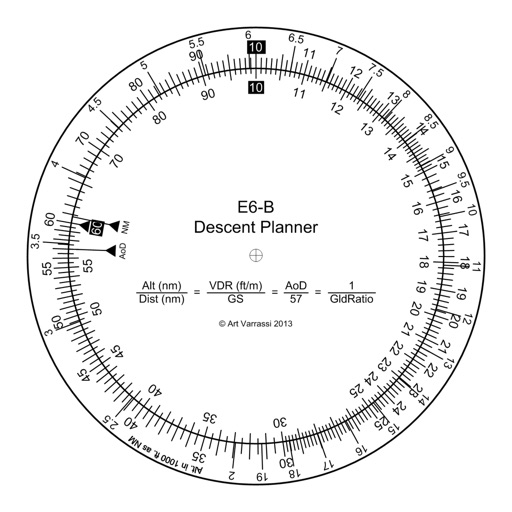
The app offers a functional circular slide rule for descent planning. It calculates top of descent distance, angle, rate, glide ratio, and maximum glide distance.
Navigation provides flight planning and in-flight calculations. Users can customize quick access buttons, configure units, and manage blocks and airtime.
Create a realistic flight simulation cockpit with a Boeing-style Flight Management System, Primary Flight Display, and Navigation Display. Connect to flight simulators via local network. Configure displays for different simulators.
Displays current with large, clear indicators. Shows both true and magnetic north. Features a minimalistic interface with a prominent display. Offers free navigation without additional costs.
The app determines a remote GPS location using compass bearings from multiple geolocated points. It supports automated or manual entry of readings and displays results on a map.
Displays current , distance, direction, and altitude in MPH, KM/H, and KNOTS. Shows decimal values. Tracks top and average . Records and altitude data for the last few hours. Supports iPhone and iPad. Includes "speak " feature for audio feedback.
Locate lost devices with real-time signal strength and live map guidance. Scan nearby devices and view distance scores. Supports AirPods, Apple Watch, AirTag, and other -enabled items.
Navigate using turn-by-turn directions and real-time traffic updates. View service history and schedule maintenance appointments. Access vehicle diagnostics and fuel efficiency reports. Secure your account with fingerprint or facial recognition.
View cameras and incidents on a map. Add cameras to favorites for easy access. Check road closures and MDOT mobility notices. Get real-time updates on highways.