

Apps Like Elevation - Altimeter Map for iPhone and iPad
View data by location
Determine using GPS, barometer, or location input. View data on interactive maps. Access real-time altitude readings. Compare changes across locations. Save and share measurements.
Elevation - Altimeter Map screenshots
Ranked alternatives
Showing 441–460 of 1,000 ranked alternatives.


Sunfollower
Evgeny Vostrikov
Sun direction for any day.
The app displays sunrise, sunset, and sun direction for any day and location. It provides civil, nautical, and astronomical twilight times, along with the Sun's elevation and azimuth, and shadow ratio.
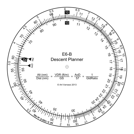
E6B Descent Planner
Arthur Varrassi
Circular slide rule for descent planning.
The app offers a functional circular slide rule for descent planning. It calculates top of descent distance, angle, rate, glide ratio, and maximum glide distance.


MapTool - GPS, Compass, Altitude, Speedometer, UTM, MGRS and Magnetic Declination
Dan Iatco
Integrated tools for outdoor navigation.
The app offers integrated navigation tools including a full-screen map, GPS, compass, altitude, UTM, and magnetic declination. It displays current altitude, speed, and UTM coordinates with precision grids for various measurements.

GPS Tour
Michael Tschuggnall
Add locations and follow the compass
Enter coordinates to set destinations and follow a compass-based route. Save location tags in a profile to mark important stops. Load, edit, and reuse profiles to navigate between saved locations.

Pear Altitude - GPS / No Ads
自力 黄
Record and track your journey
Track with real-time GPS measurements and second-level precision. Monitor oxygen levels and elevation changes. Log journeys offline and sync data later. Customize themes and access advanced tracking features without login or ads.


Speedometer Speed MPH Tracker
Rihab Mehboob
Track , record trips, view stats
View data with a display and HUD options. Track trips, record , distance, and duration. Monitor average , top , altitude, and switch between mph and km/h.

DashGo
桔 吴
Watch driving data and control dash cam
Monitor driving data including track, altitude, and speed. Connect dash cam via Wi-Fi for real-time video preview. Take photos, record videos, and download content for playback.

GPS Plus - All In One GPS
Minh Nguyen
View location data and save coordinates
View current location details including latitude, longitude, altitude, and address in Decimal or DMS format. Track trip data such as distance, speed, and maximum speed. Save location and trip information for later review.




Jetting IAME KA100 & KFS FFSA
BALLISTIC SOLUTIONS RESEARCH & DEVELOPMENT SOFTWARE SIARHEI RAICHONAK


Jetting for World Formula Kart
BALLISTIC SOLUTIONS RESEARCH & DEVELOPMENT SOFTWARE SIARHEI RAICHONAK
How we rank alternatives
Apps are ranked by functional similarity, category fit, rating confidence, and popularity.