
Sirius Navigator
Oleg Baev
Navigate with true north and altitude data
Displays magnetic and true north directions. It shows location, altitude, and barometric pressure data. Users can adjust phone light settings.

Navigate with topographic maps
View topographic maps of New Zealand's offline. Locate current position via GPS. Search for place names. Includes all map data from LINZ 1:50000 scale Topo50 series.
Showing 281–300 of 1,000 ranked alternatives.
Oleg Baev
Navigate with true north and altitude data
Displays magnetic and true north directions. It shows location, altitude, and barometric pressure data. Users can adjust phone light settings.


East End Web Solutions, Inc.
Fire Island travel made easier now.
The app provides ferry schedules and travel alerts for Fire Island communities. It also includes a business directory, event calendar, and maps for users.

LLC DimPoisk
Find companies, specialists, and services
Find businesses, specialists, and services with filters for location, reviews, and price. Search offline with preloaded city data. View locations on maps and save favorites for quick access.

Bist LLC
Navigate with voice prompts and chart support
Access vector and raster for . Create or import GPX/KML routes. Use voice prompts for route guidance. View tide and current predictions. Rotate with text remaining upright. Supports chart course orientation.


KleinCodes, LLC
Approach your station and receive alerts
Receive alerts when approaching your train station to avoid missing your stop. View real-time schedules and station information. Get updates on delays or changes to your route. Sync with your device's location to trigger notifications.

Cuisine Development LLC
Find restaurants, view menus, reserve tables
Find restaurant listings with menus, photos, amenities, and reservation options. Search by name, location, cuisine, or meal type. Get GPS directions and view detailed restaurant information.

Garzotto GmbH
Digital maps of Austria with features.
The app provides digital maps of Austria with hill shading and object names. It includes topographic maps and offers functions like searching by name or coordinates, GPS features, and measuring distances.

Cuisine Development LLC
Find restaurants in Charleston easily.
The app provides restaurant listings for Charleston, South Carolina, and nearby areas. It includes menus, photos, amenities, reservation capabilities, and GPS directions.

Ansgar Vollmer Und Till Knorr
Central Tokyo rail and subway map.
The app provides a route map for Central Tokyo. It includes a route planner, stations index, lines overview, and GPS support.

Foxbit Software Ltd.
Find stops, track buses, set reminders
Check real-time bus schedules and updates. Search for stops by name, number, or street. Set reminders for upcoming buses. Locate stops on a map and save favorites for quick access. Share bus schedules via text message.

Garafa, LLC
Cache maps, view data, explore terrain
View and analyze geographic data offline without GIS software or training. Download topographic, street, and satellite maps. Import ESRI Shapefiles and KML/KMZ files. Display attribute fields like descriptions, photos, addresses, and dates.

Ian Muriss
Find POIs, view , navigate routes
Find Points of Interest with detailed categories including hotels, banks, toilets, tourist attractions, and more. View offline with stored routes. Search for locations and navigate using built-in directions.



Kevinnovate, LLC
Customize dashboards with sensor data
Customize dashboards with configurable gauges like speedometer, odometer, GPS altimeter, barometric altimeter, accelerometer, artificial horizon, compass, and elapsed time. Swipe to switch views and access real-time sensor data from iPhone or iPad.

Steve Holmes
Find cat scales with GPS or search
Find nearby CAT locations using GPS. Search and save locations manually or via current position. View details and navigate to selected sites.

Ansgar Vollmer Und Till Knorr
Plan routes, view stations, track transfers
Navigate public transport in Central with detailed route planning and real-time GPS support. View interactive maps with high-resolution graphics and station indexes. Find transfer points and track station order on each line.
Mark Granger
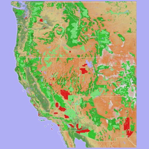
Explore 3D maps offline worldwide
Navigate using a 3D topographic map of the USA and Hawaii. Access offline vector maps for navigation in vehicles or outdoors. Switch to online maps for global coverage with automatic caching. Explore locations with zoom and scroll features.
Apps are ranked by functional similarity, category fit, rating confidence, and popularity.