

Apps Like Coverage? for iPhone and iPad
Compare coverage maps and track signal strength
Overlay cellular carrier coverage maps to compare signal strength across the USA and Canada. Search for coverage in specific areas, save maps for future reference, and plan trips based on signal availability.
Coverage? screenshots
Ranked alternatives
Showing 241–260 of 1,000 ranked alternatives.


Baylor University
Baylor University
Plan events, view maps, track schedules
View schedules and maps for campus events and New Student Orientation. Access real-time updates and plan daily activities. Navigate campus using interactive maps and directions.


MapApp NZ South Island
Saga Systems Ltd
Explore maps, find locations, track GPS
View topographic maps of New Zealand's . Locate current position via GPS. Search for place names. Access map data offline without cellular coverage. Display detailed terrain and geographical features.

airport-maps
Tobias Werner
Navigate terminals offline
Provide offline terminal maps for navigation. Include parking and approach maps for international airports. Display detailed indoor layouts without requiring an internet connection.

Vermont Outdoors
State of Vermont - Agency of Digital Services
Browse maps, hunt, fish, trap
Browse interactive maps to locate points of interest. Search for hunting, fishing, and trapping regulations. Submit reports to state agencies. Access policy information and outdoor activity details.



Utah Co Maps
Utah County Government
Search Utah County property records easily.
The app allows users to search Utah County property records by address, name, or parcel. Users can also pan and zoom a topographic map to find property details like ownership history and values.

Hawaii Ocean Map
Jorma Rodieck
Explore depths with high-resolution maps
Explore seafloor topography using NOAA's high-resolution bathymetry data. View underwater features like reefs, ledges, and channels. Access maps offline without a subscription.

Flytomap All in One HD Charts
Flytomap
Worldwide marine and outdoor maps.
The app provides worldwide marine and outdoor maps, including USA marine charts, lake maps, and parks. Users can download charts for offline use, overlay satellite and terrain features, and access interactive weather forecasts.
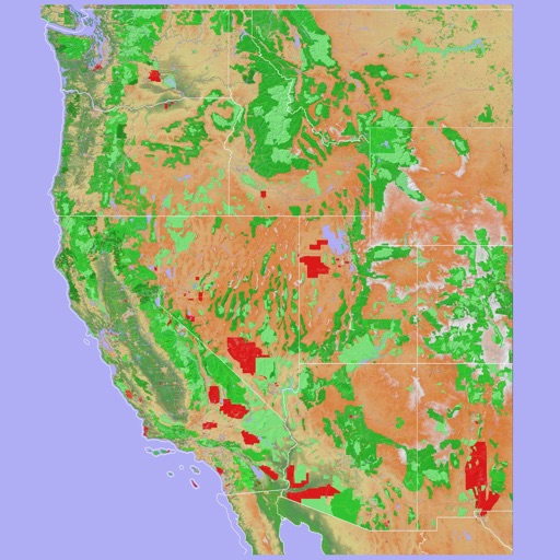
Scenic Map Western USA
Mark Granger
Explore 3D maps offline worldwide
Navigate using a 3D topographic map of the USA and Hawaii. Access offline vector maps for navigation in vehicles or outdoors. Switch to online maps for global coverage with automatic caching. Explore locations with zoom and scroll features.

Tripoli Guide
Libyan Spider IT
Explore with offline maps and AR navigation
Explore and surrounding areas with offline maps and navigation. View over 2000 points of interest. Create custom itineraries automatically. Share favorite locations and add personal notes. Use augmented reality for location-based information.

DataWidget
Qinghua Wang
Track data usage and manage Wi-Fi settings
Monitor data usage with live widgets showing upload/download speeds and real-time network insights. Set custom billing cycles and receive usage alerts. Track data for specific sessions and calibrate stats to match carrier settings.


Peepkey
Ruslan Khavriuta
Create custom maps and share locations
Create custom maps and organize locations with multiple pins. Save and share maps with friends or colleagues. Navigate from current location to a chosen destination. Mark visited places and plan delivery routes or walking tours.

How we rank alternatives
Apps are ranked by functional similarity, category fit, rating confidence, and popularity.