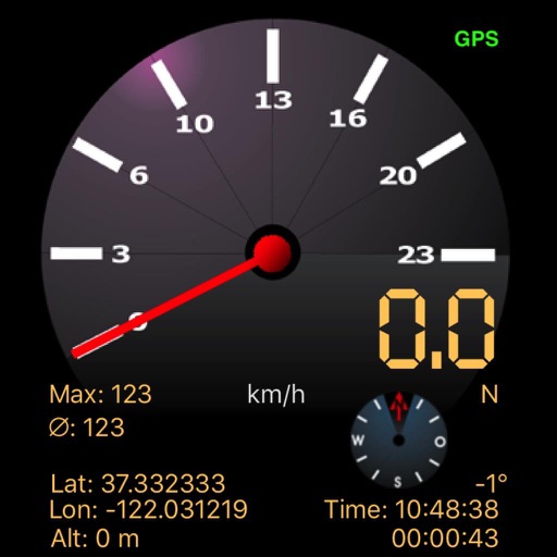
The app displays speed using GPS data, showing analog and digital readouts. It includes a compass, stopwatch, and supports multiple vehicle modes like Car, Airplane, and Sailboat.
by Kai Bruchmann★ 1.01 ratingsHealth & Fitness$0.99Data updated 2026-09-11
Land measurement tools allow precise and distance calculations on maps. Coordinate capture enables adding multiple coordinates to maps. Map exploration includes zooming, panning, and layer management.
Track parked car using GPS coordinates. View latitude and longitude details. Quickly locate spot while moving. Display precise data without extra features.
Find nearby docking stations with distance and direction. View available and docks at each station. Use full-map mode to check docks at your destination. Set a ride timer to track rental time and avoid late fees.
Locate direction using GPS and compass. Display map with current location and direction. Use accelerometer to adjust orientation. Show prayer times based on location. Track daily prayer schedule.
Track speed, average speed, maximum speed, and directional speed. Measure velocity made good and wind speed. Calculate the Pilot Performance Index to assess flight performance. Compare results with others or against autopilot settings.
Determine direction to using GPS and compass. Display distance to . Show longitude, latitude, and address. Requires GPS permission for accurate calculation.
Track time, , and distance using GPS. View through analog and digital displays. Monitor travel data with precise GPS tools. No manual setup required. Start tracking instantly upon movement.
Navigation provides perpetual almanac and star finder chart with animation. Calculates lines of position, object data, and meridian passage. Supports running fixes and astronomical position calculations with multiple star observations.