Calculate biological equivalent dose for radiation therapy using the linear-quadratic model. Select organs such as spine, heart, lung, liver, skin, or specify α/β ratios. Input dose and fractionation details to compute results.
The app provides 44 thermodynamics and heat-transfer calculators, along with reference tables. It allows users to solve for any variable and switch between SI and USCS units instantly.
View growth simulations and access statistics for 215 countries. Tap to explore GDP, GDP per capita, life expectancy, and data. Learn about each country's surface area, density, and financial indicators.
Navigation allows users to view free and maps including OpenStreetMap, OpenTopoMap, and OpenCycleMap. It supports Apple Maps integration. Users can save favorite locations, tag them, customize pin colors, and share locations.
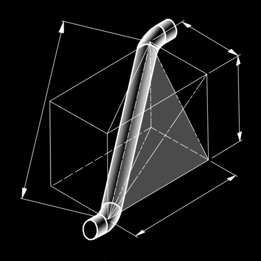
The app calculates dimensions and cut lengths for piping offset spool configurations. It presents bend angles, tangents, cut lengths, rise, run, hypotenuse, miter angles, and arc lengths.
Visualize coverage from any location on . Combine multiple radii for layered views. Check distances between points. Share data with others. Adjust size and color for clarity.
Convert units across 77 categories with over 1000 options. Perform multiple conversions on one screen. Add custom units and categories. Use built-in calculator and numeric keyboard. Convert complex measurements like height and weight between systems.
APPAS SOLUTIONS, SOCIETATEA CU RASPUNDERE LIMITATA
Capture low-light scenes with infrared and thermal
Take photos in low light using three modes. Capture infrared, X-ray, and thermal effects. Zoom in with binoculars and apply temperature effects. Adjust settings for optimal visibility in environments.
The app provides a reference for steel shapes from American standards. Geometry, detailing, and design properties are available for each shape, with full descriptions.
Visualize distances on maps with customizable circles. Set parameters and units. Display areas to check proximity of locations. Track multiple points within defined ranges.