

Apps Like NAVIAIR.GL for iPhone and iPad
NAVIAIR.GL screenshots
Ranked alternatives
Showing 201–220 of 1,000 ranked alternatives.

SkyCharts XC EFB
SkyCharts LLC
Current FAA aviation charts updated regularly.
The app provides current FAA aviation charts updated every 28 days, including approach plates for the USA. It offers VFR, IFR, and other chart types, with METAR/TAF and IFR overlays.

VesselFinder
ASTRA PAGING LTD
Track ships worldwide with live data
The app provides real-time information on ship positions and movements worldwide. It offers insight into global maritime activity with vessel particulars, port calls, and weather overlays.

Trafi
INTELLIGENT COMMUNICATIONS UAB
Find routes, check schedules, buy tickets
Find public transport routes using Route Search. Check real-time schedules for buses and trams. Buy tickets for Vilnius public transport. Minimum purchase is 5 EUR. Available in Vilnius, Kaunas, Klaipėda, Panevėžys, and Šiauliai.


iFly EFB
Adventure Pilot, LLC
Affordable capability for VFR IFR pilots.
The app offers VFR and IFR pilots an affordable, capable, and usable electronic flight bag. It provides pilots with necessary information for safe flight, featuring an intuitive interface and pilot-focused support.


FLYLOG.io - For Pilots
Breele s.r.o.
Log flight data and import records
Log flight details with a clean interface and built-in audit tools. Import records from airlines, CSV, Excel, or paper logs. Download and autofill flights using ADS-B data. Export logs in formats compliant with international aviation regulations.

PDX Bus, MAX, Streetcar & WES
Andrew Wallace
Portland public transport arrival times.
The app displays arrival times for public transport in Portland, Oregon. It uses GPS to locate nearby stops and provides interactive rail maps.



SeaDrive: Boat Navigation
SeaDrive LLC
Track routes, record trips, view charts
Navigate waterways with detailed charts, build routes, and record tracks. View tides and currents. Set waypoints and track progress. Share maps and access free US charts for safe boating.

FSWidgets QuickPlan
Fermin Fernandez
Visual flight planning for simulators.
The app generates flight plans in native FSX, FS2004, or X-Plane formats. Users create routes visually by tapping the map to add airports and waypoints, with options to remove waypoints before saving.





Spot Assist Skydiving Tool
Andrey Kan
Weather tool for parachute pilots.
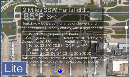
The app displays a satellite map of dropzones. It shows current windaloft and surface winds, a range of the user's parachute, and a safe jump run exit area.

Greenline - MBTA Tracker
Vladimir Grinman
Track train locations and arrival times
Track real-time Green Line train locations and arrival times. Find the nearest station and view next train arrival minutes. Use an interactive map to see train movements. Share your location with friends.
How we rank alternatives
Apps are ranked by functional similarity, category fit, rating confidence, and popularity.