Measure directions accurately using a and calculate layouts. Calculate orientations for homes, doors, kitchens, and desks. Include references for study and practice. Function as a standard when needed.
Calculate prayer times based on sun and moon positions. Display sunrise, zenith, sunset, and twilight times. Visualize prayer times with a digital sundial. Sync with location for accurate timings. Set reminders for each prayer.
Measure with high precision using internal sensors. Display directions and elevation changes. Track location and movement patterns. Set alerts and receive notifications. Sync data with external devices for detailed analysis.
The app provides practice for tasks involving compass points and degrees. Users can customize exercises to match their understanding of compass correlations, with reference values shown in degrees or compass points.
Visualize elevation, slope, and contours in 3D. Export data to DXF, SHP, CSV, OBJ, glTIF, and STL. Analyze terrain features and integrate with AutoCAD and GIS software. Perform quick data exports and simplify complex GIS tasks.
The app records vehicle travel data, displaying real-time measurements like speed, distance, and altitude. It offers features such as trip recording, customizable themes, speed limit alerts, and HUD mode.
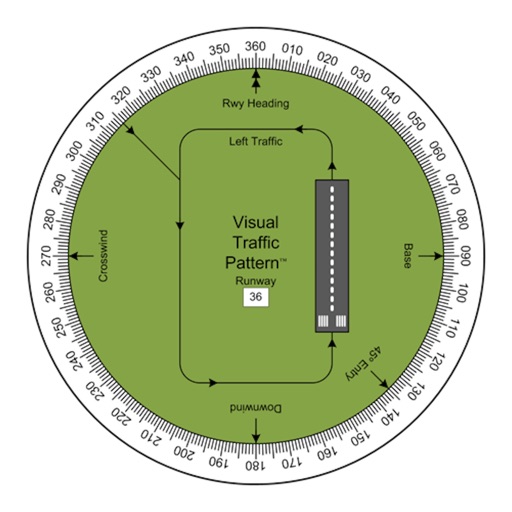
Allows pilots to view runway patterns with finger rotation. Display includes left and right patterns, crosswind, downwind, base, and 45-degree entry headings. Magnetic runway orientation matches aircraft heading for approach visualization.
Reader tool allows users to read and listen to books. Ruler tool measures length, breadth, and height of objects. Protractor tool measures angles of objects. Slope tool calculates the incline of structures. Activity track daily tasks and progress.