

Apps Like Balloon Nav for iPhone and iPad
Balloon Nav screenshots
Ranked alternatives
Showing 541–560 of 1,000 ranked alternatives.



Good Maps: Trails,Street View
光宇 张
Explore the world from home.
The app provides global exploration with features like immersive Street View, worldwide hiking trails, and multi-engine maps. It includes a smart route planner, pro-grade data, offline map capabilities, and an exploration archive for saving journeys.

Share Location&Compass
yuan hung Huang
Share location and compass directions.
The app combines compass and location sharing features. It displays the user's current address, latitude, longitude, and altitude on a map, and can share a map link via SMS or email.


JamShare
JamShare, inc.
Share links to music and locations
Share music links across apps by converting them for Spotify, Apple Music, YouTube Music, and SoundCloud. Send location links to Google Maps, Waze, and other map apps. Set default apps for one-tap sharing. Save favorite shares for reuse.


T2000ADSB
microair avionics pty ltd
Track GPS position and manage transponder data
Access and manage transponder data with editing and configuration tools. View GPS position and altitude information. Integrate with Mode A/C and ADS-B systems. Monitor and adjust transponder settings remotely.


Altimeter Offline
Arnau Egea
Offline altimeter for outdoor activities.
The app displays geographic coordinates and current elevation. It records the highest altitude reached and shows altitude in meters and feet.
E6B Descent Planner
Arthur Varrassi
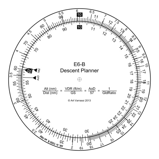
Circular slide rule for descent planning.
The app offers a functional circular slide rule for descent planning. It calculates top of descent distance, angle, rate, glide ratio, and maximum glide distance.

Windoo
JDC Electronic SA
Measure wind, temperature, humidity, pressure.
The app measures wind speed, temperature, humidity, and pressure using an iPhone or iPad. It displays instant measurements, history, and allows sharing data on social media and a map.


MuslimPilot Log
MOHAMMED AL OTAIBI
Track prayer times and flight logs
Navigation allows pilots to calculate prayer times adjusted for altitude. Import flight plans to create detailed logs. Track Fajr, Dhuhr, Asr, Maghrib, and Isha times along routes. Sync with flight data for accurate scheduling.


Share Track–GPS Route Map
Shenzhen Siyang Xunfei Technology Co., Ltd.
Record, enhance, and share GPS routes.
The app records GPS tracks, allowing users to save routes and add photos, videos, and voice notes to locations. Users can share routes with others, import GPX files, and navigate along recorded paths with real-time guidance.
How we rank alternatives
Apps are ranked by functional similarity, category fit, rating confidence, and popularity.