Measure atmospheric pressure using the device's barometric sensor. Determine elevation with GPS-based altimeter. Access a ruler, surface level, metronome, stopwatch, timer, and seismometer. Includes flashlight.
Set location during or after installation using distance and bearing. Define allowed area as a circle or custom shape with angles and distances. Monitor movement and receive alerts when boundaries are exceeded.
View real-time GPS maps and switch between map and views by holding the device. Track heading, , altitude, latitude, longitude, speed, and temperature. Use a for accurate navigation and monitor speedometer and temperature readings.
Smart LED Lightstrip allows users to adjust RGB colors, set brightness levels, and control the device remotely via voice or . It supports scheduling and automation for lighting scenes.
Monitor mower status and receive push notifications. Control operation settings and schedule mowing. View battery level and error messages. via cellular or Bluetooth for remote management. Adjust mowing patterns and access maintenance alerts.
Learn and practice IFR flying with a simulator that allows setting up custom navigation aids, aircraft position, speed, and movement. Adjust runway direction, wind conditions, and use instruments like VOR, HSI, DME, and RMI.
GPS-based digital displays current speed during driving, flying, cycling, or boating. Shows head-up display mode on car dashboard. Displays maximum speed limit and road name. Includes linear compass for direction.
Displays current outside temperature based location.
The app displays the current outside temperature based on the user's location. It shows local conditions including temperature, high and low, wind speed, and humidity.
The app provides a collection of 13 measuring tools and a flashlight. It includes a barometer, altimeter, compass, teslameter, metronome, stopwatch, timer, seismometer, plumb bob, surface level, spirit level, and ruler.
Navigate public transport in Singapore with real-time bus arrival predictions based on LTA data. View MRT/LRT maps and track multiple operators including SBS, SMRT, Tower Transit, and Go-Ahead.
The app displays local weather conditions with HD video and sound. Users can view current weather, a 6-day forecast, temperature in Celsius or Fahrenheit, and wind speed and direction.
Calculate -related conversions, fuel consumption, and navigation metrics. Perform arithmetic operations and unit conversions. Track time, distance, and speed. Sync with Apple Watch for real-time updates.
Type a message and enlarge it to fill the screen. Edit text by tapping the screen, hide keyboard by tapping again. Display latest message in a widget supporting iOS 16 lock screen. Automatically resize text for portrait and landscape orientations.
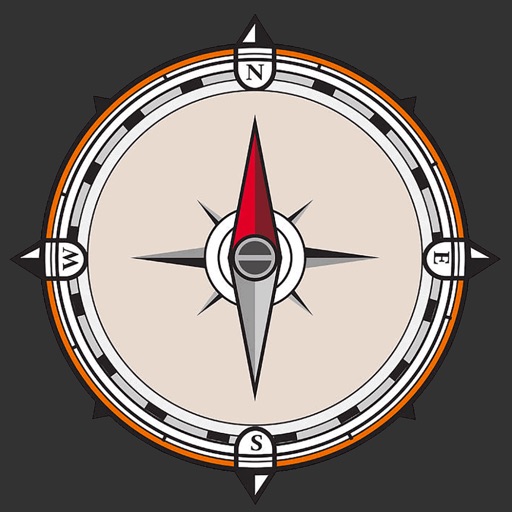
The app transforms devices into a compass with a rustic aesthetic and user-friendly interface. It provides location, altitude, and orientation using device sensors for navigation and everyday use.
Track for five daily prayers and sunrise across and UAE provinces. Set custom Athan alerts and sounds. Display Qibla direction. Sync with Apple Watch and use today widget. Compatible with Voice Over.